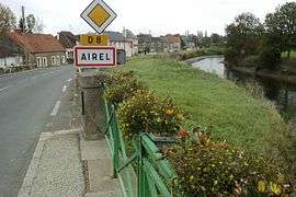
Airel
| Airel | |
|---|---|
|
View from the Saint-Fromond bridge | |
 Airel | |
|
Location within Normandy region  Airel | |
| Coordinates: 49°12′50″N 1°04′30″W / 49.214°N 1.075°WCoordinates: 49°12′50″N 1°04′30″W / 49.214°N 1.075°W | |
| Country | France |
| Region | Normandy |
| Department | Manche |
| Arrondissement | Saint-Lô |
| Canton | Saint-Clair-sur-l'Elle |
| Intercommunality | Daye |
| Government | |
| • Mayor (2008–2014) | Jacqueline Le Blond |
| Area1 | 10.17 km2 (3.93 sq mi) |
| Population (2009)2 | 528 |
| • Density | 52/km2 (130/sq mi) |
| Time zone | CET (UTC+1) |
| • Summer (DST) | CEST (UTC+2) |
| INSEE/Postal code | 50004 / 50680 |
| Elevation |
1–44 m (3.3–144.4 ft) (avg. 5 m or 16 ft) |
|
1 French Land Register data, which excludes lakes, ponds, glaciers > 1 km² (0.386 sq mi or 247 acres) and river estuaries. 2 Population without double counting: residents of multiple communes (e.g., students and military personnel) only counted once. | |
Airel is a commune in the Manche department in the Basse-Normandie region in northwestern France.
Population
| Historical population | ||
|---|---|---|
| Year | Pop. | ±% |
| 1793 | 531 | — |
| 1800 | 546 | +2.8% |
| 1806 | 549 | +0.5% |
| 1821 | 681 | +24.0% |
| 1831 | 629 | −7.6% |
| 1836 | 601 | −4.5% |
| 1841 | 609 | +1.3% |
| 1846 | 680 | +11.7% |
| 1851 | 676 | −0.6% |
| 1856 | 668 | −1.2% |
| 1861 | 719 | +7.6% |
| 1866 | 722 | +0.4% |
| 1872 | 726 | +0.6% |
| 1876 | 704 | −3.0% |
| 1881 | 761 | +8.1% |
| 1886 | 823 | +8.1% |
| 1891 | 800 | −2.8% |
| 1896 | 756 | −5.5% |
| 1901 | 756 | +0.0% |
| 1906 | 747 | −1.2% |
| 1911 | 706 | −5.5% |
| 1921 | 791 | +12.0% |
| 1926 | 822 | +3.9% |
| 1931 | 792 | −3.6% |
| 1936 | 755 | −4.7% |
| 1946 | 823 | +9.0% |
| 1954 | 753 | −8.5% |
| 1962 | 623 | −17.3% |
| 1968 | 557 | −10.6% |
| 1975 | 534 | −4.1% |
| 1982 | 548 | +2.6% |
| 1990 | 526 | −4.0% |
| 1999 | 486 | −7.6% |
| 2007 | 515 | +6.0% |
| 2009 | 528 | +2.5% |
See also
References
| Wikimedia Commons has media related to Airel. |
This article is issued from Wikipedia - version of the 8/16/2016. The text is available under the Creative Commons Attribution/Share Alike but additional terms may apply for the media files.