Lessay
| Lessay | |
|---|---|
|
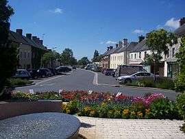
Town square | |
 Lessay | |
|
Location within Normandy region  Lessay | |
| Coordinates: 49°13′05″N 1°31′46″W / 49.218°N 1.5294°WCoordinates: 49°13′05″N 1°31′46″W / 49.218°N 1.5294°W | |
| Country | France |
| Region | Normandy |
| Department | Manche |
| Arrondissement | Coutances |
| Canton | Créances |
| Area1 | 28.95 km2 (11.18 sq mi) |
| Population (2013)2 | 2,243 |
| • Density | 77/km2 (200/sq mi) |
| Time zone | CET (UTC+1) |
| • Summer (DST) | CEST (UTC+2) |
| INSEE/Postal code | 50267 / 50430 |
| Elevation |
5–42 m (16–138 ft) (avg. 10 m or 33 ft) |
|
1 French Land Register data, which excludes lakes, ponds, glaciers > 1 km² (0.386 sq mi or 247 acres) and river estuaries. 2 Population without double counting: residents of multiple communes (e.g., students and military personnel) only counted once. | |
Lessay is a commune in the Manche department in north-western France. On 1 January 2016, the former commune of Angoville-sur-Ay was merged into Lessay.[1]
Geography
Lessay is a small town in the centre of the Cotentin Peninsula, Normandy.
History
It was originally founded as a monastery but a town grew up around it over the years. The 10th century monastery is one of the greatest examples of Romanesque architecture in Normandy. It was partially destroyed by fighting in the town during July-August 1944.
Heraldry
.svg.png) |
The arms of Lessay are blazoned : Sable, a woodsman's axe palewise Or, blade to sinister. |
Points of interest
- LORAN-C transmitter Lessay
- La Foire: the Sainte Croix fair of Lessay is a trade fair established in the 11th century in order to develop commercial activity in the village. For three days in the second week of September, 42 acres (170,000 m2) of Lessay is transformed into a marketplace, attracting over 400,000 visitors. The fair offers demonstrations of old and new trades, thousands of stalls selling a range of products from household equipment to animals, food, cars and garden and agricultural tools.[2]
- Lessay was the location for the studio for English language commercial radio station Contact 94 which was aimed at the Channel Islands before they had commercial radio of their own. The station launched on 5 September 1988 and closed in 1991.
See also
References
- ↑ Arrêté préfectoral 28 September 2015 (French)
- ↑ Lessay et son canton à travers les siècles by Michel Pinel
| Wikimedia Commons has media related to Lessay. |
This article is issued from Wikipedia - version of the 10/31/2016. The text is available under the Creative Commons Attribution/Share Alike but additional terms may apply for the media files.