La Bazoge, Manche
| La Bazoge | |
|---|---|
|
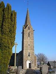
The church of Saint-Martin | |
 La Bazoge | |
|
Location within Normandy region  La Bazoge | |
| Coordinates: 48°38′48″N 1°01′40″W / 48.6467°N 1.0278°WCoordinates: 48°38′48″N 1°01′40″W / 48.6467°N 1.0278°W | |
| Country | France |
| Region | Normandy |
| Department | Manche |
| Arrondissement | Avranches |
| Canton | Juvigny-le-Tertre |
| Intercommunality | Tertre |
| Government | |
| • Mayor (2008–2014) | Jean-Yves Hamel |
| Area1 | 5.80 km2 (2.24 sq mi) |
| Population (2009)2 | 166 |
| • Density | 29/km2 (74/sq mi) |
| Time zone | CET (UTC+1) |
| • Summer (DST) | CEST (UTC+2) |
| INSEE/Postal code | 50037 / 50520 |
| Elevation |
92–212 m (302–696 ft) (avg. 203 m or 666 ft) |
|
1 French Land Register data, which excludes lakes, ponds, glaciers > 1 km² (0.386 sq mi or 247 acres) and river estuaries. 2 Population without double counting: residents of multiple communes (e.g., students and military personnel) only counted once. | |
La Bazoge is a commune in the Manche department in the Basse-Normandie region in northwestern France.
Population
| Historical population | ||
|---|---|---|
| Year | Pop. | ±% |
| 1793 | 386 | — |
| 1800 | 382 | −1.0% |
| 1806 | 421 | +10.2% |
| 1821 | 417 | −1.0% |
| 1831 | 343 | −17.7% |
| 1836 | 347 | +1.2% |
| 1841 | 353 | +1.7% |
| 1846 | 348 | −1.4% |
| 1851 | 348 | +0.0% |
| 1856 | 314 | −9.8% |
| 1861 | 297 | −5.4% |
| 1866 | 324 | +9.1% |
| 1872 | 338 | +4.3% |
| 1876 | 357 | +5.6% |
| 1881 | 346 | −3.1% |
| 1886 | 324 | −6.4% |
| 1891 | 299 | −7.7% |
| 1896 | 292 | −2.3% |
| 1901 | 288 | −1.4% |
| 1906 | 302 | +4.9% |
| 1911 | 300 | −0.7% |
| 1921 | 257 | −14.3% |
| 1926 | 272 | +5.8% |
| 1931 | 288 | +5.9% |
| 1936 | 299 | +3.8% |
| 1946 | 286 | −4.3% |
| 1954 | 264 | −7.7% |
| 1962 | 240 | −9.1% |
| 1968 | 201 | −16.2% |
| 1975 | 177 | −11.9% |
| 1982 | 172 | −2.8% |
| 1990 | 162 | −5.8% |
| 1999 | 166 | +2.5% |
| 2009 | 166 | +0.0% |
See also
References
| Wikimedia Commons has media related to La Bazoge (Manche). |
This article is issued from Wikipedia - version of the 2/18/2016. The text is available under the Creative Commons Attribution/Share Alike but additional terms may apply for the media files.