Saint-Jean-de-Daye
| Saint-Jean-de-Daye | |
|---|---|
|
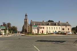
The church | |
 Saint-Jean-de-Daye | |
|
Location within Normandy region  Saint-Jean-de-Daye | |
| Coordinates: 49°13′43″N 1°08′12″W / 49.2286°N 1.1367°WCoordinates: 49°13′43″N 1°08′12″W / 49.2286°N 1.1367°W | |
| Country | France |
| Region | Normandy |
| Department | Manche |
| Arrondissement | Saint-Lô |
| Canton | Saint-Jean-de-Daye |
| Intercommunality | Région de Daye |
| Government | |
| • Mayor (2008–2014) | Nicole Godard |
| Area1 | 4.24 km2 (1.64 sq mi) |
| Population (2006)2 | 609 |
| • Density | 140/km2 (370/sq mi) |
| Time zone | CET (UTC+1) |
| • Summer (DST) | CEST (UTC+2) |
| INSEE/Postal code | 50488 / 50620 |
| Elevation |
0–47 m (0–154 ft) (avg. 43 m or 141 ft) |
|
1 French Land Register data, which excludes lakes, ponds, glaciers > 1 km² (0.386 sq mi or 247 acres) and river estuaries. 2 Population without double counting: residents of multiple communes (e.g., students and military personnel) only counted once. | |
Saint-Jean-de-Daye is a commune in the Manche department in Normandy in north-western France.
History
In 1839 Saint-Jean-de-Day, having recorded just 352 registered inhabitants in 1836, absorbed the adjacent Le Mesnil-Véneron commune of 200 people. However, the ensuing decade saw economic and demographic growth and in 1847 Le Mesnil-Véneron was reinstated as a separate commune.[1]
See also
References
| Wikimedia Commons has media related to Saint-Jean-de-Daye. |
This article is issued from Wikipedia - version of the 3/15/2016. The text is available under the Creative Commons Attribution/Share Alike but additional terms may apply for the media files.