Néhou
| Néhou | |
|---|---|
|
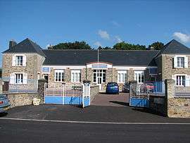
Old Town Hall | |
 Néhou | |
|
Location within Normandy region  Néhou | |
| Coordinates: 49°25′15″N 1°32′27″W / 49.4208°N 1.5408°WCoordinates: 49°25′15″N 1°32′27″W / 49.4208°N 1.5408°W | |
| Country | France |
| Region | Normandy |
| Department | Manche |
| Arrondissement | Cherbourg-Octeville |
| Canton | Saint-Sauveur-le-Vicomte |
| Intercommunality | Communauté de communes de la Vallée de l'Ouve |
| Government | |
| • Mayor (2008–2014) | Dominique Jeanne |
| Area1 | 15.98 km2 (6.17 sq mi) |
| Population (2006)2 | 521 |
| • Density | 33/km2 (84/sq mi) |
| Time zone | CET (UTC+1) |
| • Summer (DST) | CEST (UTC+2) |
| INSEE/Postal code | 50370 / 50390 |
| Elevation | 3–74 m (9.8–242.8 ft) |
|
1 French Land Register data, which excludes lakes, ponds, glaciers > 1 km² (0.386 sq mi or 247 acres) and river estuaries. 2 Population without double counting: residents of multiple communes (e.g., students and military personnel) only counted once. | |
Néhou is a commune in the Manche department in Normandy in north-western France.
See also
| Wikimedia Commons has media related to Néhou. |
This article is issued from Wikipedia - version of the 2/27/2015. The text is available under the Creative Commons Attribution/Share Alike but additional terms may apply for the media files.