Domjean
| Domjean | |
|---|---|
|
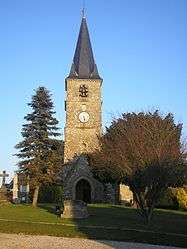
L'église Saint-Jean-Baptiste | |
 Domjean | |
|
Location within Normandy region  Domjean | |
| Coordinates: 48°59′16″N 1°01′52″W / 48.9878°N 1.0311°WCoordinates: 48°59′16″N 1°01′52″W / 48.9878°N 1.0311°W | |
| Country | France |
| Region | Normandy |
| Department | Manche |
| Arrondissement | Saint-Lô |
| Canton | Tessy-sur-Vire |
| Intercommunality | sans |
| Government | |
| • Mayor (2008–2014) | Guy Gauchet |
| Area1 | 16.57 km2 (6.40 sq mi) |
| Population (2006)2 | 958 |
| • Density | 58/km2 (150/sq mi) |
| Time zone | CET (UTC+1) |
| • Summer (DST) | CEST (UTC+2) |
| INSEE/Postal code | 50164 / 50420 |
| Elevation | 30–178 m (98–584 ft) |
|
1 French Land Register data, which excludes lakes, ponds, glaciers > 1 km² (0.386 sq mi or 247 acres) and river estuaries. 2 Population without double counting: residents of multiple communes (e.g., students and military personnel) only counted once. | |
Domjean is a commune in the Manche department in north-western France.
See also
| Wikimedia Commons has media related to Domjean. |
This article is issued from Wikipedia - version of the 8/16/2016. The text is available under the Creative Commons Attribution/Share Alike but additional terms may apply for the media files.