Ravenoville
| Ravenoville | |
|---|---|
|
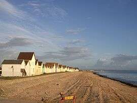
Cabins along the beach | |
 Ravenoville | |
|
Location within Normandy region  Ravenoville | |
| Coordinates: 49°27′27″N 1°16′10″W / 49.4575°N 1.2694°WCoordinates: 49°27′27″N 1°16′10″W / 49.4575°N 1.2694°W | |
| Country | France |
| Region | Normandy |
| Department | Manche |
| Arrondissement | Cherbourg-Octeville |
| Canton | Sainte-Mère-Église |
| Intercommunality | Communauté de communes de Sainte-Mère-Église |
| Government | |
| • Mayor (2008–2014) | Pierre Aubril |
| Area1 | 11.65 km2 (4.50 sq mi) |
| Population (2006)2 | 245 |
| • Density | 21/km2 (54/sq mi) |
| Time zone | CET (UTC+1) |
| • Summer (DST) | CEST (UTC+2) |
| INSEE/Postal code | 50427 / 50480 |
| Elevation |
0–12 m (0–39 ft) (avg. 10 m or 33 ft) |
|
1 French Land Register data, which excludes lakes, ponds, glaciers > 1 km² (0.386 sq mi or 247 acres) and river estuaries. 2 Population without double counting: residents of multiple communes (e.g., students and military personnel) only counted once. | |
Ravenoville is a commune in the Manche department in north-western France.
Geography
Ravenoville is divided into 2 towns: Ravenoville-Bourg and Ravenoville-Plage. A sinuous route of about 1.25 miles through the pastureland of Normandy links them.
History
Ravenoville, close to Utah Beach, on the evening of June 5, 1944 and throughout the day of June 6, 1944, lived through the Allied D-Day landing.
See also
| Wikimedia Commons has media related to Ravenoville. |
This article is issued from Wikipedia - version of the 2/27/2015. The text is available under the Creative Commons Attribution/Share Alike but additional terms may apply for the media files.