La Pernelle
| La Pernelle | |
|---|---|
|
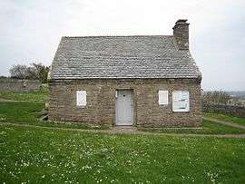
Town hall and former guardhouse | |
 La Pernelle | |
|
Location within Normandy region  La Pernelle | |
| Coordinates: 49°37′14″N 1°17′51″W / 49.6206°N 1.2975°WCoordinates: 49°37′14″N 1°17′51″W / 49.6206°N 1.2975°W | |
| Country | France |
| Region | Normandy |
| Department | Manche |
| Arrondissement | Cherbourg-Octeville |
| Canton | Quettehou |
| Intercommunality | Communauté de communes du Val de Saire |
| Government | |
| • Mayor (2008–2014) | Marc Gauchet |
| Area1 | 7.23 km2 (2.79 sq mi) |
| Population (2006)2 | 261 |
| • Density | 36/km2 (93/sq mi) |
| Time zone | CET (UTC+1) |
| • Summer (DST) | CEST (UTC+2) |
| INSEE/Postal code | 50395 / 50630 |
| Elevation |
1–121 m (3.3–397.0 ft) (avg. 112 m or 367 ft) |
|
1 French Land Register data, which excludes lakes, ponds, glaciers > 1 km² (0.386 sq mi or 247 acres) and river estuaries. 2 Population without double counting: residents of multiple communes (e.g., students and military personnel) only counted once. | |
La Pernelle is a commune in the Manche department in Normandy in north-western France.
Places of Interest
- The panorama from the top of the hill extends from coast West of the Phare de Gatteville to Saint-Vaast-la-Hougue and beyond, along the South-Eastern coast of the Manche department.
- The town hall is one of the smallest in France.
- The replica of the Grotto of Our Lady of Lourdes.
See also
| Wikimedia Commons has media related to La Pernelle. |
This article is issued from Wikipedia - version of the 2/27/2015. The text is available under the Creative Commons Attribution/Share Alike but additional terms may apply for the media files.