Aumeville-Lestre
| Aumeville-Lestre | |
|---|---|
|
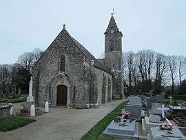
Saint-Pierre church | |
 Aumeville-Lestre | |
|
Location within Normandy region  Aumeville-Lestre | |
| Coordinates: 49°32′25″N 1°19′12″W / 49.5403°N 1.32°WCoordinates: 49°32′25″N 1°19′12″W / 49.5403°N 1.32°W | |
| Country | France |
| Region | Normandy |
| Department | Manche |
| Arrondissement | Cherbourg-Octeville |
| Canton | Quettehou |
| Intercommunality | Val de Saire |
| Government | |
| • Mayor (2008–2014) | Bernard Gosselin |
| Area1 | 2.44 km2 (0.94 sq mi) |
| Population (2009)2 | 144 |
| • Density | 59/km2 (150/sq mi) |
| Time zone | CET (UTC+1) |
| • Summer (DST) | CEST (UTC+2) |
| INSEE/Postal code | 50022 / 50630 |
| Elevation |
2–41 m (6.6–134.5 ft) (avg. 10 m or 33 ft) |
|
1 French Land Register data, which excludes lakes, ponds, glaciers > 1 km² (0.386 sq mi or 247 acres) and river estuaries. 2 Population without double counting: residents of multiple communes (e.g., students and military personnel) only counted once. | |
Aumeville-Lestre is a commune in the Manche department in the Basse-Normandie region in northwestern France.
Population
| Historical population | ||
|---|---|---|
| Year | Pop. | ±% |
| 1793 | 213 | — |
| 1800 | 230 | +8.0% |
| 1806 | 263 | +14.3% |
| 1821 | 269 | +2.3% |
| 1831 | 234 | −13.0% |
| 1836 | 236 | +0.9% |
| 1841 | 263 | +11.4% |
| 1846 | 266 | +1.1% |
| 1851 | 252 | −5.3% |
| 1856 | 230 | −8.7% |
| 1861 | 240 | +4.3% |
| 1866 | 228 | −5.0% |
| 1872 | 217 | −4.8% |
| 1876 | 195 | −10.1% |
| 1881 | 216 | +10.8% |
| 1886 | 194 | −10.2% |
| 1891 | 187 | −3.6% |
| 1896 | 198 | +5.9% |
| 1901 | 217 | +9.6% |
| 1906 | 212 | −2.3% |
| 1911 | 205 | −3.3% |
| 1921 | 179 | −12.7% |
| 1926 | 178 | −0.6% |
| 1931 | 187 | +5.1% |
| 1936 | 166 | −11.2% |
| 1946 | 169 | +1.8% |
| 1954 | 182 | +7.7% |
| 1962 | 181 | −0.5% |
| 1968 | 156 | −13.8% |
| 1975 | 147 | −5.8% |
| 1982 | 153 | +4.1% |
| 1990 | 134 | −12.4% |
| 1999 | 139 | +3.7% |
| 2009 | 144 | +3.6% |
See also
References
| Wikimedia Commons has media related to Aumeville-Lestre. |
This article is issued from Wikipedia - version of the 8/16/2016. The text is available under the Creative Commons Attribution/Share Alike but additional terms may apply for the media files.