Belval, Manche
| Belval | ||
|---|---|---|
|
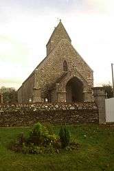
The church of Saint-Martin | ||
| ||
 Belval | ||
|
Location within Normandy region  Belval | ||
| Coordinates: 49°02′25″N 1°21′45″W / 49.0403°N 1.3625°WCoordinates: 49°02′25″N 1°21′45″W / 49.0403°N 1.3625°W | ||
| Country | France | |
| Region | Normandy | |
| Department | Manche | |
| Arrondissement | Coutances | |
| Canton | Cerisy-la-Salle | |
| Intercommunality | Cerisy-la-Salle | |
| Government | ||
| • Mayor (2008–2014) | Yves Duchemin | |
| Area1 | 5.72 km2 (2.21 sq mi) | |
| Population (2009)2 | 303 | |
| • Density | 53/km2 (140/sq mi) | |
| Time zone | CET (UTC+1) | |
| • Summer (DST) | CEST (UTC+2) | |
| INSEE/Postal code | 50044 / 50210 | |
| Elevation |
32–145 m (105–476 ft) (avg. 85 m or 279 ft) | |
|
1 French Land Register data, which excludes lakes, ponds, glaciers > 1 km² (0.386 sq mi or 247 acres) and river estuaries. 2 Population without double counting: residents of multiple communes (e.g., students and military personnel) only counted once. | ||
Belval is a commune in the Manche department in the Basse-Normandie region in northwestern France.
Population
| Historical population | ||
|---|---|---|
| Year | Pop. | ±% |
| 1793 | 556 | — |
| 1800 | 557 | +0.2% |
| 1806 | 595 | +6.8% |
| 1821 | 626 | +5.2% |
| 1831 | 535 | −14.5% |
| 1836 | 513 | −4.1% |
| 1841 | 509 | −0.8% |
| 1846 | 516 | +1.4% |
| 1851 | 496 | −3.9% |
| 1856 | 485 | −2.2% |
| 1861 | 448 | −7.6% |
| 1866 | 451 | +0.7% |
| 1872 | 448 | −0.7% |
| 1876 | 450 | +0.4% |
| 1881 | 405 | −10.0% |
| 1886 | 402 | −0.7% |
| 1891 | 405 | +0.7% |
| 1896 | 403 | −0.5% |
| 1901 | 304 | −24.6% |
| 1906 | 334 | +9.9% |
| 1911 | 334 | +0.0% |
| 1921 | 281 | −15.9% |
| 1926 | 283 | +0.7% |
| 1931 | 298 | +5.3% |
| 1936 | 286 | −4.0% |
| 1946 | 309 | +8.0% |
| 1954 | 324 | +4.9% |
| 1962 | 314 | −3.1% |
| 1968 | 290 | −7.6% |
| 1975 | 234 | −19.3% |
| 1982 | 253 | +8.1% |
| 1990 | 274 | +8.3% |
| 1999 | 274 | +0.0% |
| 2009 | 303 | +10.6% |
Heraldry
.svg.png) |
The arms of Belval are blazoned : Argent, a rose gules seeded Or slipped and leaved vert, chaussé vert. |
See also
References
| Wikimedia Commons has media related to Belval (Manche). |
This article is issued from Wikipedia - version of the 4/18/2016. The text is available under the Creative Commons Attribution/Share Alike but additional terms may apply for the media files.