Montbray
For the Anglo-Norman baronial house, see Mowbray.
| Montbray | |
|---|---|
|
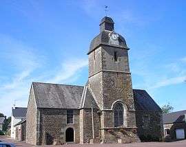
The chapel of Saint-Pierre | |
 Montbray | |
|
Location within Normandy region  Montbray | |
| Coordinates: 48°52′52″N 1°05′40″W / 48.8811°N 1.0944°WCoordinates: 48°52′52″N 1°05′40″W / 48.8811°N 1.0944°W | |
| Country | France |
| Region | Normandy |
| Department | Manche |
| Arrondissement | Saint-Lô |
| Canton | Percy |
| Intercommunality | Communauté de communes du canton de Percy |
| Government | |
| • Mayor (2008–2014) | Michel Delabroise |
| Area1 | 14.04 km2 (5.42 sq mi) |
| Population (2006)2 | 376 |
| • Density | 27/km2 (69/sq mi) |
| Time zone | CET (UTC+1) |
| • Summer (DST) | CEST (UTC+2) |
| INSEE/Postal code | 50338 / 50410 |
| Elevation |
79–266 m (259–873 ft) (avg. 90 m or 300 ft) |
|
1 French Land Register data, which excludes lakes, ponds, glaciers > 1 km² (0.386 sq mi or 247 acres) and river estuaries. 2 Population without double counting: residents of multiple communes (e.g., students and military personnel) only counted once. | |
Montbray is a commune in the Manche department in Normandy in north-western France.
The village has an ancient château which belongs to the commune and houses the marie and the village nursery school. The village also has a church, a bar, a bakery, a garage and a children's play area with picnic tables and a pond.
See also
| Wikimedia Commons has media related to Montbray. |
This article is issued from Wikipedia - version of the 2/28/2015. The text is available under the Creative Commons Attribution/Share Alike but additional terms may apply for the media files.