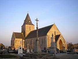
Montmartin-en-Graignes
| Montmartin-en-Graignes | |
|---|---|
 | |
 Montmartin-en-Graignes | |
|
Location within Normandy region  Montmartin-en-Graignes | |
| Coordinates: 49°16′34″N 1°08′43″W / 49.2761°N 1.1453°WCoordinates: 49°16′34″N 1°08′43″W / 49.2761°N 1.1453°W | |
| Country | France |
| Region | Normandy |
| Department | Manche |
| Arrondissement | Saint-Lô |
| Canton | Saint-Jean-de-Daye |
| Intercommunality | Communauté de communes de la région de Daye |
| Government | |
| • Mayor (2008–2014) | Hubert Lhonneur |
| Area1 | 30.34 km2 (11.71 sq mi) |
| Population (2006)2 | 540 |
| • Density | 18/km2 (46/sq mi) |
| Time zone | CET (UTC+1) |
| • Summer (DST) | CEST (UTC+2) |
| INSEE/Postal code | 50348 / 50620 |
| Elevation |
0–38 m (0–125 ft) (avg. 32 m or 105 ft) |
|
1 French Land Register data, which excludes lakes, ponds, glaciers > 1 km² (0.386 sq mi or 247 acres) and river estuaries. 2 Population without double counting: residents of multiple communes (e.g., students and military personnel) only counted once. | |
Montmartin-en-Graignes is a commune in the Manche department in Normandy in north-western France.
See also
| Wikimedia Commons has media related to Montmartin-en-Graignes. |
This article is issued from Wikipedia - version of the 2/28/2015. The text is available under the Creative Commons Attribution/Share Alike but additional terms may apply for the media files.