Teurthéville-Bocage
| Teurthéville-Bocage | |
|---|---|
|
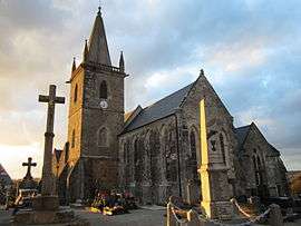
The church of Sainte-Trinité | |
 Teurthéville-Bocage | |
|
Location within Normandy region  Teurthéville-Bocage | |
| Coordinates: 49°35′34″N 1°23′42″W / 49.5928°N 1.395°WCoordinates: 49°35′34″N 1°23′42″W / 49.5928°N 1.395°W | |
| Country | France |
| Region | Normandy |
| Department | Manche |
| Arrondissement | Cherbourg-Octeville |
| Canton | Quettehou |
| Intercommunality | Communauté de communes du Val de Saire |
| Government | |
| • Mayor (2008–2014) | Serge Laurent |
| Area1 | 21.47 km2 (8.29 sq mi) |
| Population (2006)2 | 582 |
| • Density | 27/km2 (70/sq mi) |
| Time zone | CET (UTC+1) |
| • Summer (DST) | CEST (UTC+2) |
| INSEE/Postal code | 50593 / 50630 |
| Elevation |
32–116 m (105–381 ft) (avg. 80 m or 260 ft) |
|
1 French Land Register data, which excludes lakes, ponds, glaciers > 1 km² (0.386 sq mi or 247 acres) and river estuaries. 2 Population without double counting: residents of multiple communes (e.g., students and military personnel) only counted once. | |
Teurthéville-Bocage is a commune in the Manche department in Normandy in north-western France.
See also
| Wikimedia Commons has media related to Teurthéville-Bocage. |
This article is issued from Wikipedia - version of the 2/24/2015. The text is available under the Creative Commons Attribution/Share Alike but additional terms may apply for the media files.