Baudre
| Baudre | |
|---|---|
|
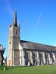
Church of Saint Ouen | |
 Baudre | |
|
Location within Normandy region  Baudre | |
| Coordinates: 49°05′24″N 1°04′19″W / 49.09°N 1.0719°WCoordinates: 49°05′24″N 1°04′19″W / 49.09°N 1.0719°W | |
| Country | France |
| Region | Normandy |
| Department | Manche |
| Arrondissement | Saint-Lô |
| Canton | Saint-Lô-Est |
| Intercommunality | Agglomération saint-loise |
| Government | |
| • Mayor (2008–2014) | Daniel Joret |
| Area1 | 3.81 km2 (1.47 sq mi) |
| Population (2009)2 | 538 |
| • Density | 140/km2 (370/sq mi) |
| Time zone | CET (UTC+1) |
| • Summer (DST) | CEST (UTC+2) |
| INSEE/Postal code | 50034 / 50000 |
| Elevation |
14–93 m (46–305 ft) (avg. 70 m or 230 ft) |
|
1 French Land Register data, which excludes lakes, ponds, glaciers > 1 km² (0.386 sq mi or 247 acres) and river estuaries. 2 Population without double counting: residents of multiple communes (e.g., students and military personnel) only counted once. | |
Baudre is a commune in the Manche department in the Basse-Normandie region in northwestern France.
Population
| Historical population | ||
|---|---|---|
| Year | Pop. | ±% |
| 1793 | 377 | — |
| 1800 | 368 | −2.4% |
| 1806 | 415 | +12.8% |
| 1821 | 364 | −12.3% |
| 1831 | 374 | +2.7% |
| 1836 | 397 | +6.1% |
| 1841 | 363 | −8.6% |
| 1846 | 360 | −0.8% |
| 1851 | 370 | +2.8% |
| 1856 | 326 | −11.9% |
| 1861 | 308 | −5.5% |
| 1866 | 270 | −12.3% |
| 1872 | 282 | +4.4% |
| 1876 | 291 | +3.2% |
| 1881 | 282 | −3.1% |
| 1886 | 282 | +0.0% |
| 1891 | 260 | −7.8% |
| 1896 | 234 | −10.0% |
| 1901 | 223 | −4.7% |
| 1906 | 228 | +2.2% |
| 1911 | 232 | +1.8% |
| 1921 | 213 | −8.2% |
| 1926 | 224 | +5.2% |
| 1931 | 234 | +4.5% |
| 1936 | 254 | +8.5% |
| 1946 | 256 | +0.8% |
| 1954 | 212 | −17.2% |
| 1962 | 215 | +1.4% |
| 1968 | 247 | +14.9% |
| 1975 | 295 | +19.4% |
| 1982 | 371 | +25.8% |
| 1990 | 365 | −1.6% |
| 1999 | 356 | −2.5% |
| 2006 | 460 | +29.2% |
| 2009 | 538 | +17.0% |
See also
References
| Wikimedia Commons has media related to Baudre. |
This article is issued from Wikipedia - version of the 9/16/2015. The text is available under the Creative Commons Attribution/Share Alike but additional terms may apply for the media files.