Boone County, Missouri
| Boone County, Missouri | ||
|---|---|---|
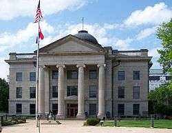 The Boone County Courthouse at the Boone County Government Complex | ||
| ||
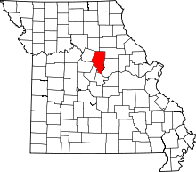 Location in the U.S. state of Missouri | ||
 Missouri's location in the U.S. | ||
| Founded | November 16, 1820 | |
| Named for | Daniel Boone | |
| Seat | Columbia | |
| Largest city | Columbia | |
| Area | ||
| • Total | 691 sq mi (1,790 km2) | |
| • Land | 685 sq mi (1,774 km2) | |
| • Water | 5.6 sq mi (15 km2), 0.8% | |
| Population (est.) | ||
| • (2015) | 174,974 | |
| • Density | 237/sq mi (92/km²) | |
| Congressional district | 4th | |
| Time zone | Central: UTC-6/-5 | |
| Website |
www | |

Boone County is a county in the U.S. state of Missouri. As of the 2010 census, the population was 162,642;[1] a 2015 estimate put the population at 174,974, making it the state's seventh-most populous county. Its county seat is Columbia,[2] Missouri's fourth-largest city. The county was organized November 16, 1820 and named for Daniel Boone.[3]
Boone County comprises the Columbia, MO Metropolitan Statistical Area.
The University of Missouri is in Columbia.
History
Boone County was organized November 16, 1820, from a portion of the territorial Howard County. The area was then known as Boone's Lick Country, because of a salt lick which Daniel Boone's sons used for their stock.
Boone County was settled primarily from the Upper South states of Kentucky, Tennessee and Virginia. The settlers brought slaves and slave-holding with them, and quickly started cultivating crops similar to those in Middle Tennessee and Kentucky: hemp and tobacco. Boone was one of several counties settled by Southerners to the north and south of the Missouri River. Because of its culture and traditions, the area became known as Little Dixie, and Boone County was at its heart.[4] In 1860 slaves made up 25 percent or more of the county's population, and Little Dixie was strongly pro-Confederate during the American Civil War.[5]
Geography
According to the U.S. Census Bureau, the county has a total area of 496 square miles (1,280 km2), of which 685 square miles (1,770 km2) is land and 5.6 square miles (15 km2) (0.8%) is water.[6] The Missouri River makes up the southern border of the county.
National protected area
- Mark Twain National Forest (part)
Adjacent counties
- Audrain County (northeast)
- Callaway County (east)
- Cole County (south)
- Cooper County (west)
- Howard County (northwest)
- Moniteau County (southwest)
- Randolph County (north)
Major highways
Demographics
| Historical population | |||
|---|---|---|---|
| Census | Pop. | %± | |
| 1830 | 8,859 | — | |
| 1840 | 13,561 | 53.1% | |
| 1850 | 14,979 | 10.5% | |
| 1860 | 19,486 | 30.1% | |
| 1870 | 20,765 | 6.6% | |
| 1880 | 25,422 | 22.4% | |
| 1890 | 26,043 | 2.4% | |
| 1900 | 28,642 | 10.0% | |
| 1910 | 30,533 | 6.6% | |
| 1920 | 29,672 | −2.8% | |
| 1930 | 30,995 | 4.5% | |
| 1940 | 34,991 | 12.9% | |
| 1950 | 48,432 | 38.4% | |
| 1960 | 55,202 | 14.0% | |
| 1970 | 80,911 | 46.6% | |
| 1980 | 100,376 | 24.1% | |
| 1990 | 112,379 | 12.0% | |
| 2000 | 135,454 | 20.5% | |
| 2010 | 162,642 | 20.1% | |
| Est. 2015 | 174,974 | [7] | 7.6% |
| U.S. Decennial Census[8] 1790-1960[9] 1900-1990[10] 1990-2000[11] 2010-2015[1] | |||
As of the census[12] of 2000, there were 135,454 people, 53,094 households, and 31,378 families residing in the county. The population density was 198 people per square mile (76/km²). There were 56,678 housing units at an average density of 83 per square mile (32/km²). The racial makeup of the county was 85.43% White, 8.54% Black or African American, 0.42% Native American, 2.96% Asian, 0.03% Pacific Islander, 0.69% from other races, and 1.93% from two or more races. Approximately 1.78% of the population were Hispanic or Latino of any race. 24.6% claimed German, 12.3% American, 11.2% English and 9.8% Irish ancestry.
There were 53,094 households out of which 30.30% had children under the age of 18 living with them, 45.50% were married couples living together, 10.40% had a female householder with no husband present, and 40.90% were non-families. 28.70% of all households were made up of individuals and 6.20% had someone living alone who was 65 years of age or older. The average household size was 2.38 and the average family size was 2.97.
In the county the population was spread out with 22.80% under the age of 18, 19.90% from 18 to 24, 29.90% from 25 to 44, 18.80% from 45 to 64, and 8.60% who were 65 years of age or older. The median age was 30 years. For every 100 females there were 93.50 males. For every 100 females age 18 and over, there were 90.90 males.
The median income for a household in the county was $37,485, and the median income for a family was $51,210. Males had a median income of $33,304 versus $25,990 for females. The per capita income for the county was $19,844. About 7.60% of families and 14.50% of the population were below the poverty line, including 12.10% of those under age 18 and 5.90% of those age 65 or over.
There are 121,319 registered voters.[13]
Education
Public schools
- Centralia R-VI School District – Centralia
- Chance Elementary School (PK-02)
- Centralia Intermediate School (03-05)
- Chester Boren Middle School (06-08)
- Centralia High School (09-12)
- Columbia School District No. 93 – Columbia
- Center for Gifted Education (01-05)
- Cedar Ridge Elementary School (PK-05)
- Thomas Benton Elementary School (PK-05)
- John Ridgeway Elementary School (K-05)
- Eugene Field/Hart Lewis Elementary School (PK-05)
- Midway Heights Elementary School (PK-05)
- Ulysses S. Grant Elementary School (PK-05)
- Two Mile Prairie Elementary School (PK-05)
- New Haven Elementary School (PK-05)
- West Boulevard Elementary School (PK-05)
- Robert E. Lee Elementary School (PK-05)
- Parkade Elementary School (PK-05)
- Blue Ridge Elementary School (PK-05)
- Fairview Elementary School (PK-05)
- Russell Boulevard Elementary School (PK-05)
- Shepard Boulevard Elementary School (PK-05)
- Mary Paxton Keeley Elementary School (PK-05)
- Derby Ridge Elementary School (PK-05)
- Mill Creek Elementary School (PK-05)
- John B. Lange Middle School (06-08)
- Ann Hawkins Gentry Middle School (06-08)
- Smithton Middle School (06-08)
- Oakland Middle School (06-08)
- Jefferson Middle School (06-08)
- West Middle School (06-08)
- Muriel Battle High School (09-12)
- Frederick Douglass High School (09-12) – Alternative School
- Rock Bridge High School (09-12)
- David H. Hickman High School (09-12)
- Hallsville R-IV School District – Hallsville
- Hallsville Primary School (PK-01)
- Hallsville Intermediate School (02-05)
- Hallsville Middle School (06-08)
- Hallsville High School (09-12)
- Harrisburg R-VIII School District – Harrisburg
- Harrisburg Elementary School (PK-06)
- Harrisburg Middle School (07-08)
- Harrisburg High School (09-12)
- Sturgeon R-V School District – Sturgeon
- Sturgeon Elementary School (K-04)
- Sturgeon Middle School (05-08)
- Sturgeon High School (09-12)
Private schools
- Apple School – Columbia (PK-K) – Nonsectarian
- Children's House And Windsor Street Montessori – Columbia (PK-06) – Nonsectarian – Coed
- Christian Chapel Academy – Columbia (K-08) – Pentecostal
- Christian Fellowship School – Columbia (PK-12) – Nondenominational Christian
- College Park Christian Academy – Columbia (K-09) – Seventh-day Adventist
- Columbia Catholic School – Columbia (K-08) – Roman Catholic
- Columbia Independent School – Columbia (PK-12) – Nonsectarian
- Columbia KinderCare – Columbia (NS-PK) – Nonsectarian
- Columbia Montessori School – Columbia (PK-K) – Nonsectarian
- Father Tolton Regional High School - Columbia (09-12) - Roman Catholic
- Good Shepherd Lutheran School – Columbia (K-08) – Lutheran
- Heritage Academy – Columbia (03-12) – Nondenominational Christian – Alternative School
- Islamic School of Columbia, Missouri – Columbia (K-05) – Muslim
- Morningside Community School – Columbia (05-07) – Nonsectarian
- Shalom Christian Academy – Columbia (PK-12) – Nonsectarian
- Harrisburg Early Learning Center – Harrisburg (NS/PK-06)
- Sunnydale Adventist Academy – Centralia (09-12) – Seventh-day Adventist
Post secondary
- University of Missouri – Columbia A public, four-year flagship university.
- Columbia College – Columbia A private, four-year university.
- Stephens College – Columbia A private, four-year women’s university.
- Moberly Area Community College (MACC), a two-year public college, operates a Columbia satellite campus.
Politics
Local
Like nearly all counties nationwide with a major university, the Democratic Party predominantly controls politics at the local level in Boone County. Democrats currently hold all of the elected positions in the county.
| Boone County, Missouri | ||||
|---|---|---|---|---|
| Elected countywide officials | ||||
| Assessor | Tom Schauwecker | Democratic | ||
| Circuit Clerk | Christy Blakemore | Democratic | ||
| County Clerk | Wendy S. Noren | Democratic | ||
| Collector | Brian McCollum | Democratic | ||
| Commissioner (Presiding) |
Dan Atwill | Democratic | ||
| Commissioner (District 1) |
Karen M. Miller | Democratic | ||
| Commissioner (District 2) |
Janet Thompson | Democratic | ||
| Prosecuting Attorney | Dan Knight | Democratic | ||
| Public Administrator | Cathy D. Richards | Democratic | ||
| Recorder | Nora Dietzel | Democratic | ||
| Sheriff | Robert Dwayne Carey | Democratic | ||
| Treasurer | Tom Darrough | Democratic | ||
State
| Year | Republican | Democratic | Third Parties |
|---|---|---|---|
| 2012 | 37.59% 29,171 | 58.38% 45,302 | 4.03% 3,125 |
| 2008 | 42.71% 35,785 | 55.28% 46,315 | 2.01% 1,688 |
| 2004 | 47.33% 35,666 | 51.08% 38,489 | 1.59% 1,201 |
| 2000 | 43.13% 25,609 | 52.22% 31,007 | 4.65% 2,767 |
| 1996 | 30.51% 15,929 | 65.62% 34,266 | 3.87% 2,021 |
Boone County is divided into five legislative districts in the Missouri House of Representatives, two of which are held by Democrats and three held by Republicans.
- District 44 – Caleb Rowden (R-Columbia). Consists of the communities of Centralia, Hallsville, Sturgeon, and northeastern Columbia.
| Party | Candidate | Votes | % | ± | |
|---|---|---|---|---|---|
| Republican | Caleb Rowden | 5,107 | 62.9 | +12.12 | |
| Democratic | Thomas Pauley | 3,012 | 38.2 | -12.12 | |
| Party | Candidate | Votes | % | ± | |
|---|---|---|---|---|---|
| Republican | Caleb Rowden | 7,801 | 50.78 | ||
| Democratic | Ken Jacob | 7,560 | 49.22 | ||
- District 45 – Kip Kendrick (D-Columbia). Consists of the north-central part of the city of Columbia.
| Party | Candidate | Votes | % | ± | |
|---|---|---|---|---|---|
| Democratic | Kip Kendrick | 3,889 | 100.00 | ||
| Party | Candidate | Votes | % | ± | |
|---|---|---|---|---|---|
| Democratic | Chris Kelly | 10,274 | 100.00 | ||
- District 46 – Stephen Webber (D-Columbia). Consists of the southern part of the city of Columbia.
| Party | Candidate | Votes | % | ± | |
|---|---|---|---|---|---|
| Democratic | Stephen Webber | 7,948 | 100.00 | ||
| Party | Candidate | Votes | % | ± | |
|---|---|---|---|---|---|
| Democratic | Stephen Webber | 12,202 | 65.02 | ||
| Republican | Fred Berry | 6,564 | 34.98 | ||
- District 47 – Charles Basye (R-Rocheport). Consists of the western part of the city of Columbia and the communities of Harrisburg and Rocheport.
| Party | Candidate | Votes | % | ± | |
|---|---|---|---|---|---|
| Republican | Charles (Chuck) Basye | 3,902 | 49.26 | +3.05 | |
| Democratic | John Wright | 4,020 | 50.74 | -3.05 | |
| Party | Candidate | Votes | % | ± | |
|---|---|---|---|---|---|
| Democratic | John Wright | 6,988 | 53.79 | ||
| Republican | Mitch Richards | 6,003 | 46.21 | ||
- District 50 – Caleb Jones (R-Columbia). Consists of parts of the city of Columbia and the communities of Ashland, Hartsburg, and McBaine.
| Party | Candidate | Votes | % | ± | |
|---|---|---|---|---|---|
| Republican | Caleb Jones | 5,600 | 100.00 | ||
| Party | Candidate | Votes | % | ± | |
|---|---|---|---|---|---|
| Republican | Caleb Jones | 9,667 | 100.00 | ||
All of Boone County is a part of Missouri’s 19th District in the Missouri Senate and is currently represented by Kurt Schaefer (R-Columbia).
| Party | Candidate | Votes | % | ± | |
|---|---|---|---|---|---|
| Republican | Kurt Schaefer | 41,780 | 56.48 | +8.67 | |
| Democratic | Mary Wynne Still | 32,197 | 43.52 | -3.83 | |
| Party | Candidate | Votes | % | ± | |
|---|---|---|---|---|---|
| Republican | Kurt Schaefer | 38,659 | 47.81 | ||
| Democratic | Chuck Graham | 38,290 | 47.35 | ||
| Libertarian | Christopher W. Dwyer | 3,911 | 4.84 | ||
Federal
| Party | Candidate | Votes | % | ± | |
|---|---|---|---|---|---|
| Democratic | Claire McCaskill | 46,332 | 59.42 | ||
| Republican | Todd Akin | 25,431 | 32.61 | ||
| Libertarian | Jonathan Dine | 6,217 | 7.97 | ||
All of Boone County is included in Missouri’s 4th Congressional District and is currently represented by Vicky Hartzler (R-Harrisonville) in the U.S. House of Representatives.
| Party | Candidate | Votes | % | ± | |
|---|---|---|---|---|---|
| Republican | Vicky Hartzler | 21,089 | 52.38 | +6.04 | |
| Democratic | Nate Irvin | 16,762 | 41.63 | -6.69 | |
| Libertarian | Hershel L. Young | 2,411 | 5.99 | +1.60 | |
| Party | Candidate | Votes | % | ± | |
|---|---|---|---|---|---|
| Republican | Vicky Hartzler | 34,167 | 46.34 | ||
| Democratic | Teresa Hensley | 35,625 | 48.32 | ||
| Libertarian | Thomas Holbrook | 3,240 | 4.39 | ||
| Constitution | Greg Cowan | 696 | 0.94 | ||
Political culture
| Year | Republican | Democratic | Third Parties |
|---|---|---|---|
| 2012 | 47.10% 37,404 | 50.17% 39,847 | 2.73% 2,171 |
| 2008 | 43.22% 36,849 | 55.20% 47,062 | 1.58% 1,340 |
| 2004 | 49.71% 37,801 | 49.50% 37,643 | 0.79% 604 |
| 2000 | 47.69% 28,426 | 48.33% 28,811 | 3.98% 2,372 |
| 1996 | 42.46% 22,047 | 48.12% 24,984 | 9.42% 4,889 |
Missouri Presidential Preference Primary (2008)
- Former U.S. Senator and current President Barack Obama (D-Illinois) received more votes, a total of 15,750, than any candidate from either party in Boone County during the 2008 presidential primary.
| Boone County, Missouri | ||
|---|---|---|
| 2008 Republican primary in Missouri | ||
| John McCain | 4,948 (31.26%) | |
| Mike Huckabee | 3,838 (24.25%) | |
| Mitt Romney | 5,688 (35.94%) | |
| Ron Paul | 1,047 (6.62%) | |
| Boone County, Missouri | ||
|---|---|---|
| 2008 Democratic primary in Missouri | ||
| Hillary Clinton | 9,601 (36.92%) | |
| Barack Obama | 15,750 (60.57%) | |
| John Edwards (withdrawn) | 396 (1.52%) | |
Communities
Cities
Villages
Unincorporated communities
Townships
Public safety

The Boone County Fire Protection District provides fire protection and emergency medical services for a large portion of Boone County, Missouri.[16] The BCFPD is the largest volunteer fire department and third largest fire service organization in the state, protecting 492 square miles (1,270 km2) of residential, commercial, industrial and agricultural property and over 50,000 people.[16] The Boone County Fire District maintains 14 fire stations, a training center, and a headquarters facility.[17]
History
Prior to 1964, there was no organized fire protection in Boone County. This changed after an elderly handicapped woman died in a house fire just west of the city limits of Columbia. A small group of CB radio enthusiasts, known as the Central Missouri Radio Squad, banded together to develop a fire protection system for Boone County.[18]
USAR Task Force
Boone County Fire is the sponsoring agency of Urban Search and Rescue Missouri Task Force 1 (MO-TF1) which is one of the 28 FEMA Urban Search and Rescue Task Forces across the United States.[19] The team is made up of 210 members that are qualified in various aspects of urban search and rescue.[20]
See also
- List of counties in Missouri
- National Register of Historic Places listings in Boone County, Missouri
References
- 1 2 "State & County QuickFacts". United States Census Bureau. Archived from the original on April 17, 2016. Retrieved September 16, 2016.
- ↑ "Find a County". National Association of Counties. Archived from the original on 2011-05-31. Retrieved 2011-06-07.
- ↑ Eaton, David Wolfe (1916). How Missouri Counties, Towns and Streams Were Named. The State Historical Society of Missouri. p. 211.
- ↑ The Story of Little Dixie, Missouri, Missouri Division, Sons of Confederate Veterans, accessed 3 June 2008
- ↑ T. J. Stiles, Jesse James: The Last Rebel of the Civil War, New York: Vintage Books, 2003, pp.10-11
- ↑ "2010 Census Gazetteer Files". United States Census Bureau. August 22, 2012. Retrieved November 13, 2014.
- ↑ "County Totals Dataset: Population, Population Change and Estimated Components of Population Change: April 1, 2010 to July 1, 2015". Retrieved July 2, 2016.
- ↑ "U.S. Decennial Census". United States Census Bureau. Archived from the original on May 11, 2015. Retrieved November 13, 2014.
- ↑ "Historical Census Browser". University of Virginia Library. Retrieved November 13, 2014.
- ↑ "Population of Counties by Decennial Census: 1900 to 1990". United States Census Bureau. Retrieved November 13, 2014.
- ↑ "Census 2000 PHC-T-4. Ranking Tables for Counties: 1990 and 2000" (PDF). United States Census Bureau. Retrieved November 13, 2014.
- ↑ "American FactFinder". United States Census Bureau. Archived from the original on 2013-09-11. Retrieved 2011-05-14.
- ↑ Registered Voters in Missouri 2008
- 1 2 3 4 5 6 "County Results, State of Missouri - General Election - November 4, 2014". Retrieved March 23, 2016.
- 1 2 3 4 5 6 7 8 "County Results, State of Missouri - General Election - November 6, 2012". Retrieved March 23, 2016.
- 1 2 "Fun Facts". Boone County Fire. Retrieved 22 May 2015.
- ↑ "Boone County Fire Protection District" (PDF). Bcfdmo.coma. Retrieved 2012-11-16.
- ↑ "History". Boone County Fire Protection District. Retrieved 27 May 2015.
- ↑ "US&R Task Force Locations". FEMA. Retrieved August 28, 2006.
- ↑ "USAR Task Force". Boone County Fire. Retrieved 22 May 2015.
Further reading
- History of Boone County, Missouri: Written and comp. from the most authentic official and private sources; including a history of its townships, towns, and villages. Together with ... biographical sketches and portraits of prominent citizens (1882) online
External links
- Digitized 1930 Plat Book of Boone County from University of Missouri Division of Special Collections, Archives, and Rare Books
 |
Howard County | Randolph County | Audrain County | |
| Cooper County | |
Callaway County | ||
| ||||
| | ||||
| Moniteau County | Cole County |
Municipalities and communities of Boone County, Missouri, United States | ||
|---|---|---|
| Cities | | |
| Villages | ||
| Townships | ||
| Unincorporated communities | ||
| Ghost towns | ||
| Footnotes | ‡This populated place also has portions in an adjacent county or counties | |