Champmillon
| Champmillon | |
|---|---|
 | |
 Champmillon | |
|
Location within Nouvelle-Aquitaine region  Champmillon | |
| Coordinates: 45°38′23″N 0°00′02″E / 45.6397°N 0.00056°ECoordinates: 45°38′23″N 0°00′02″E / 45.6397°N 0.00056°E | |
| Country | France |
| Region | Nouvelle-Aquitaine |
| Department | Charente |
| Arrondissement | Angoulême |
| Canton | Hiersac |
| Intercommunality | Région de Châteauneuf |
| Government | |
| • Mayor (2008–2014) | Bernard Popelard |
| Area1 | 9.51 km2 (3.67 sq mi) |
| Population (2008)2 | 526 |
| • Density | 55/km2 (140/sq mi) |
| Time zone | CET (UTC+1) |
| • Summer (DST) | CEST (UTC+2) |
| INSEE/Postal code | 16077 / 16290 |
| Elevation |
21–97 m (69–318 ft) (avg. 96 m or 315 ft) |
|
1 French Land Register data, which excludes lakes, ponds, glaciers > 1 km² (0.386 sq mi or 247 acres) and river estuaries. 2 Population without double counting: residents of multiple communes (e.g., students and military personnel) only counted once. | |
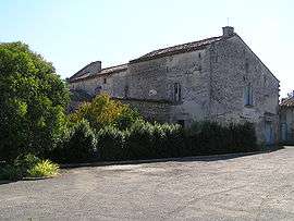
Champmillon is a commune in the Charente department in southwestern France.
Population
| Historical population | ||
|---|---|---|
| Year | Pop. | ±% |
| 1793 | 464 | — |
| 1800 | 563 | +21.3% |
| 1806 | 555 | −1.4% |
| 1821 | 604 | +8.8% |
| 1831 | 578 | −4.3% |
| 1841 | 575 | −0.5% |
| 1846 | 559 | −2.8% |
| 1851 | 520 | −7.0% |
| 1856 | 518 | −0.4% |
| 1861 | 542 | +4.6% |
| 1866 | 518 | −4.4% |
| 1872 | 474 | −8.5% |
| 1876 | 456 | −3.8% |
| 1881 | 473 | +3.7% |
| 1886 | 430 | −9.1% |
| 1891 | 403 | −6.3% |
| 1896 | 373 | −7.4% |
| 1901 | 395 | +5.9% |
| 1906 | 408 | +3.3% |
| 1911 | 394 | −3.4% |
| 1921 | 318 | −19.3% |
| 1926 | 325 | +2.2% |
| 1931 | 313 | −3.7% |
| 1936 | 286 | −8.6% |
| 1946 | 307 | +7.3% |
| 1954 | 317 | +3.3% |
| 1962 | 320 | +0.9% |
| 1968 | 302 | −5.6% |
| 1975 | 346 | +14.6% |
| 1982 | 358 | +3.5% |
| 1990 | 449 | +25.4% |
| 1999 | 490 | +9.1% |
| 2008 | 526 | +7.3% |
See also
References
| Wikimedia Commons has media related to Champmillon. |
This article is issued from Wikipedia - version of the 2/11/2016. The text is available under the Creative Commons Attribution/Share Alike but additional terms may apply for the media files.