Mansle
| Mansle | ||
|---|---|---|
|
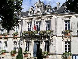
Town hall | ||
| ||
 Mansle | ||
|
Location within Nouvelle-Aquitaine region  Mansle | ||
| Coordinates: 45°52′37″N 0°10′46″E / 45.8769°N 0.1794°ECoordinates: 45°52′37″N 0°10′46″E / 45.8769°N 0.1794°E | ||
| Country | France | |
| Region | Nouvelle-Aquitaine | |
| Department | Charente | |
| Arrondissement | Confolens | |
| Canton | Mansle | |
| Intercommunality | Pays Manslois | |
| Government | ||
| • Mayor (2008–2014) | Michel Harmand | |
| Area1 | 5.75 km2 (2.22 sq mi) | |
| Population (2008)2 | 1,520 | |
| • Density | 260/km2 (680/sq mi) | |
| Time zone | CET (UTC+1) | |
| • Summer (DST) | CEST (UTC+2) | |
| INSEE/Postal code | 16206 / 16230 | |
| Elevation |
55–115 m (180–377 ft) (avg. 60 m or 200 ft) | |
|
1 French Land Register data, which excludes lakes, ponds, glaciers > 1 km² (0.386 sq mi or 247 acres) and river estuaries. 2 Population without double counting: residents of multiple communes (e.g., students and military personnel) only counted once. | ||
.svg.png)
Mansle is a commune in the Charente department in southwestern France. It is about 20 km north of Angoulême on the main N10 road.
Population
| Historical population | ||
|---|---|---|
| Year | Pop. | ±% |
| 1793 | 1,250 | — |
| 1800 | 1,231 | −1.5% |
| 1806 | 1,254 | +1.9% |
| 1821 | 1,626 | +29.7% |
| 1831 | 1,785 | +9.8% |
| 1841 | 1,857 | +4.0% |
| 1846 | 1,968 | +6.0% |
| 1851 | 1,919 | −2.5% |
| 1856 | 1,860 | −3.1% |
| 1861 | 1,899 | +2.1% |
| 1866 | 1,900 | +0.1% |
| 1872 | 1,830 | −3.7% |
| 1876 | 1,823 | −0.4% |
| 1881 | 1,825 | +0.1% |
| 1886 | 1,721 | −5.7% |
| 1891 | 1,611 | −6.4% |
| 1896 | 1,537 | −4.6% |
| 1901 | 1,585 | +3.1% |
| 1906 | 1,609 | +1.5% |
| 1911 | 1,587 | −1.4% |
| 1921 | 1,463 | −7.8% |
| 1926 | 1,409 | −3.7% |
| 1931 | 1,424 | +1.1% |
| 1936 | 1,327 | −6.8% |
| 1946 | 1,287 | −3.0% |
| 1954 | 1,271 | −1.2% |
| 1962 | 1,324 | +4.2% |
| 1968 | 1,413 | +6.7% |
| 1975 | 1,595 | +12.9% |
| 1982 | 1,486 | −6.8% |
| 1990 | 1,601 | +7.7% |
| 1999 | 1,596 | −0.3% |
| 2008 | 1,520 | −4.8% |
See also
References
| Wikimedia Commons has media related to Mansle. |
This article is issued from Wikipedia - version of the 2/22/2013. The text is available under the Creative Commons Attribution/Share Alike but additional terms may apply for the media files.