Villegats, Charente
| Villegats | |
|---|---|
|
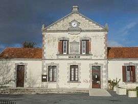
Town hall | |
 Villegats | |
|
Location within Nouvelle-Aquitaine region  Villegats | |
| Coordinates: 45°59′33″N 0°11′37″E / 45.9925°N 0.1936°ECoordinates: 45°59′33″N 0°11′37″E / 45.9925°N 0.1936°E | |
| Country | France |
| Region | Nouvelle-Aquitaine |
| Department | Charente |
| Arrondissement | Confolens |
| Canton | Ruffec |
| Intercommunality | Trois Vallées |
| Government | |
| • Mayor (2008–2014) | Marc Vigier |
| Area1 | 7.71 km2 (2.98 sq mi) |
| Population (2008)2 | 244 |
| • Density | 32/km2 (82/sq mi) |
| Time zone | CET (UTC+1) |
| • Summer (DST) | CEST (UTC+2) |
| INSEE/Postal code | 16410 / 16700 |
| Elevation |
91–161 m (299–528 ft) (avg. 133 m or 436 ft) |
|
1 French Land Register data, which excludes lakes, ponds, glaciers > 1 km² (0.386 sq mi or 247 acres) and river estuaries. 2 Population without double counting: residents of multiple communes (e.g., students and military personnel) only counted once. | |
Villegats is a commune in the Charente department in southwestern France.
Population
| Historical population | ||
|---|---|---|
| Year | Pop. | ±% |
| 1793 | 453 | — |
| 1800 | 485 | +7.1% |
| 1806 | 452 | −6.8% |
| 1821 | 513 | +13.5% |
| 1831 | 550 | +7.2% |
| 1841 | 461 | −16.2% |
| 1846 | 524 | +13.7% |
| 1851 | 468 | −10.7% |
| 1856 | 433 | −7.5% |
| 1861 | 388 | −10.4% |
| 1866 | 394 | +1.5% |
| 1872 | 407 | +3.3% |
| 1876 | 382 | −6.1% |
| 1881 | 384 | +0.5% |
| 1886 | 355 | −7.6% |
| 1891 | 354 | −0.3% |
| 1896 | 347 | −2.0% |
| 1901 | 324 | −6.6% |
| 1906 | 315 | −2.8% |
| 1911 | 298 | −5.4% |
| 1921 | 268 | −10.1% |
| 1926 | 252 | −6.0% |
| 1931 | 237 | −6.0% |
| 1936 | 238 | +0.4% |
| 1946 | 250 | +5.0% |
| 1954 | 230 | −8.0% |
| 1962 | 262 | +13.9% |
| 1968 | 234 | −10.7% |
| 1975 | 209 | −10.7% |
| 1982 | 258 | +23.4% |
| 1990 | 245 | −5.0% |
| 1999 | 264 | +7.8% |
| 2008 | 244 | −7.6% |
See also
References
| Wikimedia Commons has media related to Villegats (Charente). |
This article is issued from Wikipedia - version of the 2/28/2013. The text is available under the Creative Commons Attribution/Share Alike but additional terms may apply for the media files.