Éraville
| Éraville | |
|---|---|
|
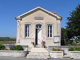
Town hall | |
 Éraville | |
|
Location within Nouvelle-Aquitaine region  Éraville | |
| Coordinates: 45°34′41″N 0°05′27″W / 45.5781°N 0.0908°WCoordinates: 45°34′41″N 0°05′27″W / 45.5781°N 0.0908°W | |
| Country | France |
| Region | Nouvelle-Aquitaine |
| Department | Charente |
| Arrondissement | Cognac |
| Canton | Châteauneuf-sur-Charente |
| Government | |
| • Mayor (2008–2014) | Chantal Hillairet |
| Area1 | 5.47 km2 (2.11 sq mi) |
| Population (2008)2 | 186 |
| • Density | 34/km2 (88/sq mi) |
| Time zone | CET (UTC+1) |
| • Summer (DST) | CEST (UTC+2) |
| INSEE/Postal code | 16129 / 16120 |
| Elevation |
33–108 m (108–354 ft) (avg. 83 m or 272 ft) |
|
1 French Land Register data, which excludes lakes, ponds, glaciers > 1 km² (0.386 sq mi or 247 acres) and river estuaries. 2 Population without double counting: residents of multiple communes (e.g., students and military personnel) only counted once. | |
Éraville is a commune in the Charente department in southwestern France.
Population
| Historical population | ||
|---|---|---|
| Year | Pop. | ±% |
| 1793 | 262 | — |
| 1800 | 298 | +13.7% |
| 1806 | 262 | −12.1% |
| 1821 | 308 | +17.6% |
| 1831 | 283 | −8.1% |
| 1841 | 262 | −7.4% |
| 1846 | 302 | +15.3% |
| 1851 | 300 | −0.7% |
| 1856 | 303 | +1.0% |
| 1861 | 330 | +8.9% |
| 1866 | 332 | +0.6% |
| 1872 | 362 | +9.0% |
| 1876 | 309 | −14.6% |
| 1881 | 254 | −17.8% |
| 1886 | 234 | −7.9% |
| 1891 | 189 | −19.2% |
| 1896 | 195 | +3.2% |
| 1901 | 204 | +4.6% |
| 1906 | 196 | −3.9% |
| 1911 | 189 | −3.6% |
| 1921 | 197 | +4.2% |
| 1926 | 230 | +16.8% |
| 1931 | 225 | −2.2% |
| 1936 | 217 | −3.6% |
| 1946 | 224 | +3.2% |
| 1954 | 238 | +6.2% |
| 1962 | 213 | −10.5% |
| 1968 | 202 | −5.2% |
| 1975 | 183 | −9.4% |
| 1982 | 186 | +1.6% |
| 1990 | 192 | +3.2% |
| 1999 | 177 | −7.8% |
| 2008 | 186 | +5.1% |
See also
References
| Wikimedia Commons has media related to Éraville. |
This article is issued from Wikipedia - version of the 2/22/2013. The text is available under the Creative Commons Attribution/Share Alike but additional terms may apply for the media files.