Touvérac
| Touvérac | |
|---|---|
|
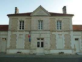
Town hall | |
 Touvérac | |
|
Location within Nouvelle-Aquitaine region  Touvérac | |
| Coordinates: 45°23′03″N 0°13′07″W / 45.3842°N 0.2186°WCoordinates: 45°23′03″N 0°13′07″W / 45.3842°N 0.2186°W | |
| Country | France |
| Region | Nouvelle-Aquitaine |
| Department | Charente |
| Arrondissement | Cognac |
| Canton | Baignes-Sainte-Radegonde |
| Intercommunality | 3B - Sud-Charente |
| Government | |
| • Mayor (2008–2014) | Jacky Hugues |
| Area1 | 18.19 km2 (7.02 sq mi) |
| Population (2008)2 | 744 |
| • Density | 41/km2 (110/sq mi) |
| Time zone | CET (UTC+1) |
| • Summer (DST) | CEST (UTC+2) |
| INSEE/Postal code | 16384 / 16360 |
| Elevation |
68–156 m (223–512 ft) (avg. 105 m or 344 ft) |
|
1 French Land Register data, which excludes lakes, ponds, glaciers > 1 km² (0.386 sq mi or 247 acres) and river estuaries. 2 Population without double counting: residents of multiple communes (e.g., students and military personnel) only counted once. | |
Touvérac is a commune in the Charente department in southwestern France.
Population
| Historical population | ||
|---|---|---|
| Year | Pop. | ±% |
| 1793 | 584 | — |
| 1800 | 594 | +1.7% |
| 1806 | 556 | −6.4% |
| 1821 | 780 | +40.3% |
| 1831 | 766 | −1.8% |
| 1841 | 738 | −3.7% |
| 1846 | 831 | +12.6% |
| 1851 | 775 | −6.7% |
| 1856 | 777 | +0.3% |
| 1861 | 776 | −0.1% |
| 1866 | 755 | −2.7% |
| 1872 | 722 | −4.4% |
| 1876 | 679 | −6.0% |
| 1881 | 677 | −0.3% |
| 1886 | 665 | −1.8% |
| 1891 | 666 | +0.2% |
| 1896 | 607 | −8.9% |
| 1901 | 582 | −4.1% |
| 1906 | 653 | +12.2% |
| 1911 | 636 | −2.6% |
| 1921 | 609 | −4.2% |
| 1926 | 546 | −10.3% |
| 1931 | 649 | +18.9% |
| 1936 | 757 | +16.6% |
| 1946 | 791 | +4.5% |
| 1954 | 846 | +7.0% |
| 1962 | 721 | −14.8% |
| 1968 | 722 | +0.1% |
| 1975 | 668 | −7.5% |
| 1982 | 765 | +14.5% |
| 1990 | 643 | −15.9% |
| 1999 | 577 | −10.3% |
| 2008 | 744 | +28.9% |
See also
References
| Wikimedia Commons has media related to Touvérac. |
This article is issued from Wikipedia - version of the 2/27/2013. The text is available under the Creative Commons Attribution/Share Alike but additional terms may apply for the media files.