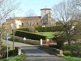
Yvrac-et-Malleyrand
| Yvrac-et-Malleyrand | |
|---|---|
 | |
 Yvrac-et-Malleyrand | |
|
Location within Nouvelle-Aquitaine region  Yvrac-et-Malleyrand | |
| Coordinates: 45°45′03″N 0°26′55″E / 45.7508°N 0.4486°ECoordinates: 45°45′03″N 0°26′55″E / 45.7508°N 0.4486°E | |
| Country | France |
| Region | Nouvelle-Aquitaine |
| Department | Charente |
| Arrondissement | Angoulême |
| Canton | La Rochefoucauld |
| Intercommunality | Bandiat-Tardoire |
| Government | |
| • Mayor (2008–2014) | Serge Frugier |
| Area1 | 18.90 km2 (7.30 sq mi) |
| Population (2008)2 | 530 |
| • Density | 28/km2 (73/sq mi) |
| Time zone | CET (UTC+1) |
| • Summer (DST) | CEST (UTC+2) |
| INSEE/Postal code | 16425 / 16110 |
| Elevation |
109–315 m (358–1,033 ft) (avg. 210 m or 690 ft) |
|
1 French Land Register data, which excludes lakes, ponds, glaciers > 1 km² (0.386 sq mi or 247 acres) and river estuaries. 2 Population without double counting: residents of multiple communes (e.g., students and military personnel) only counted once. | |
Yvrac-et-Malleyrand is a commune in the Charente department in southwestern France.
Population
| Historical population | ||
|---|---|---|
| Year | Pop. | ±% |
| 1793 | 900 | — |
| 1800 | 1,033 | +14.8% |
| 1806 | 977 | −5.4% |
| 1821 | 1,039 | +6.3% |
| 1831 | 952 | −8.4% |
| 1841 | 1,075 | +12.9% |
| 1846 | 1,067 | −0.7% |
| 1851 | 1,052 | −1.4% |
| 1856 | 991 | −5.8% |
| 1861 | 962 | −2.9% |
| 1866 | 920 | −4.4% |
| 1872 | 875 | −4.9% |
| 1876 | 921 | +5.3% |
| 1881 | 952 | +3.4% |
| 1886 | 962 | +1.1% |
| 1891 | 914 | −5.0% |
| 1896 | 824 | −9.8% |
| 1901 | 775 | −5.9% |
| 1906 | 754 | −2.7% |
| 1911 | 725 | −3.8% |
| 1921 | 748 | +3.2% |
| 1926 | 682 | −8.8% |
| 1931 | 653 | −4.3% |
| 1936 | 623 | −4.6% |
| 1946 | 602 | −3.4% |
| 1954 | 569 | −5.5% |
| 1962 | 506 | −11.1% |
| 1968 | 481 | −4.9% |
| 1975 | 420 | −12.7% |
| 1982 | 403 | −4.0% |
| 1990 | 432 | +7.2% |
| 1999 | 465 | +7.6% |
| 2008 | 530 | +14.0% |
See also
References
| Wikimedia Commons has media related to Yvrac-et-Malleyrand. |
This article is issued from Wikipedia - version of the 7/21/2016. The text is available under the Creative Commons Attribution/Share Alike but additional terms may apply for the media files.