Mainzac
| Mainzac | |
|---|---|
|
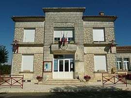
Town hall | |
 Mainzac | |
|
Location within Nouvelle-Aquitaine region  Mainzac | |
| Coordinates: 45°33′10″N 0°29′11″E / 45.5528°N .48639°ECoordinates: 45°33′10″N 0°29′11″E / 45.5528°N .48639°E | |
| Country | France |
| Region | Nouvelle-Aquitaine |
| Department | Charente |
| Arrondissement | Angoulême |
| Canton | Montbron |
| Intercommunality | Seuil Charente-Périgord |
| Government | |
| • Mayor (2008–2014) | Patrice Dominici |
| Area1 | 11.29 km2 (4.36 sq mi) |
| Population (2008)2 | 115 |
| • Density | 10/km2 (26/sq mi) |
| Time zone | CET (UTC+1) |
| • Summer (DST) | CEST (UTC+2) |
| INSEE/Postal code | 16203 / 16380 |
| Elevation |
119–192 m (390–630 ft) (avg. 160 m or 520 ft) |
|
1 French Land Register data, which excludes lakes, ponds, glaciers > 1 km² (0.386 sq mi or 247 acres) and river estuaries. 2 Population without double counting: residents of multiple communes (e.g., students and military personnel) only counted once. | |
Mainzac is a commune in the Charente department in southwestern France.
Population
| Historical population | ||
|---|---|---|
| Year | Pop. | ±% |
| 1793 | 402 | — |
| 1800 | 431 | +7.2% |
| 1806 | 437 | +1.4% |
| 1821 | 418 | −4.3% |
| 1831 | 445 | +6.5% |
| 1841 | 438 | −1.6% |
| 1846 | 448 | +2.3% |
| 1851 | 443 | −1.1% |
| 1856 | 417 | −5.9% |
| 1861 | 405 | −2.9% |
| 1866 | 387 | −4.4% |
| 1872 | 363 | −6.2% |
| 1876 | 327 | −9.9% |
| 1881 | 353 | +8.0% |
| 1886 | 318 | −9.9% |
| 1891 | 324 | +1.9% |
| 1896 | 283 | −12.7% |
| 1901 | 274 | −3.2% |
| 1906 | 265 | −3.3% |
| 1911 | 308 | +16.2% |
| 1921 | 252 | −18.2% |
| 1926 | 272 | +7.9% |
| 1931 | 238 | −12.5% |
| 1936 | 223 | −6.3% |
| 1946 | 196 | −12.1% |
| 1954 | 198 | +1.0% |
| 1962 | 177 | −10.6% |
| 1968 | 157 | −11.3% |
| 1975 | 121 | −22.9% |
| 1982 | 110 | −9.1% |
| 1990 | 121 | +10.0% |
| 1999 | 102 | −15.7% |
| 2008 | 115 | +12.7% |
See also
References
| Wikimedia Commons has media related to Mainzac. |
This article is issued from Wikipedia - version of the 2/11/2016. The text is available under the Creative Commons Attribution/Share Alike but additional terms may apply for the media files.