Parzac
| Parzac | |
|---|---|
|
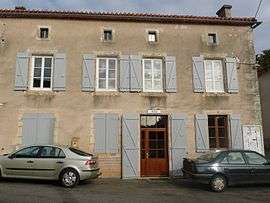
Town hall | |
 Parzac | |
|
Location within Nouvelle-Aquitaine region  Parzac | |
| Coordinates: 45°56′02″N 0°25′02″E / 45.9339°N 0.4172°ECoordinates: 45°56′02″N 0°25′02″E / 45.9339°N 0.4172°E | |
| Country | France |
| Region | Nouvelle-Aquitaine |
| Department | Charente |
| Arrondissement | Confolens |
| Canton | Saint-Claud |
| Intercommunality | Haute-Charente |
| Government | |
| • Mayor (2008–2014) | Pierre Madier |
| Area1 | 11.38 km2 (4.39 sq mi) |
| Population (2008)2 | 133 |
| • Density | 12/km2 (30/sq mi) |
| Time zone | CET (UTC+1) |
| • Summer (DST) | CEST (UTC+2) |
| INSEE/Postal code | 16255 / 16450 |
| Elevation |
105–182 m (344–597 ft) (avg. 100 m or 330 ft) |
|
1 French Land Register data, which excludes lakes, ponds, glaciers > 1 km² (0.386 sq mi or 247 acres) and river estuaries. 2 Population without double counting: residents of multiple communes (e.g., students and military personnel) only counted once. | |
Parzac is a commune in the Charente department in southwestern France.
Population
| Historical population | ||
|---|---|---|
| Year | Pop. | ±% |
| 1793 | 674 | — |
| 1800 | 712 | +5.6% |
| 1806 | 747 | +4.9% |
| 1821 | 802 | +7.4% |
| 1831 | 804 | +0.2% |
| 1841 | 749 | −6.8% |
| 1846 | 716 | −4.4% |
| 1851 | 738 | +3.1% |
| 1856 | 671 | −9.1% |
| 1861 | 651 | −3.0% |
| 1866 | 631 | −3.1% |
| 1872 | 610 | −3.3% |
| 1876 | 615 | +0.8% |
| 1881 | 600 | −2.4% |
| 1886 | 580 | −3.3% |
| 1891 | 600 | +3.4% |
| 1896 | 534 | −11.0% |
| 1901 | 521 | −2.4% |
| 1906 | 472 | −9.4% |
| 1911 | 447 | −5.3% |
| 1921 | 414 | −7.4% |
| 1926 | 407 | −1.7% |
| 1931 | 360 | −11.5% |
| 1936 | 366 | +1.7% |
| 1946 | 291 | −20.5% |
| 1954 | 258 | −11.3% |
| 1962 | 264 | +2.3% |
| 1968 | 234 | −11.4% |
| 1975 | 178 | −23.9% |
| 1982 | 163 | −8.4% |
| 1990 | 136 | −16.6% |
| 1999 | 127 | −6.6% |
| 2008 | 133 | +4.7% |
See also
References
| Wikimedia Commons has media related to Parzac. |
This article is issued from Wikipedia - version of the 2/22/2013. The text is available under the Creative Commons Attribution/Share Alike but additional terms may apply for the media files.