Tusson
| Tusson | ||
|---|---|---|
|
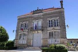
Town hall | ||
| ||
 Tusson | ||
|
Location within Nouvelle-Aquitaine region  Tusson | ||
| Coordinates: 45°56′06″N 0°04′09″E / 45.935°N 0.0692°ECoordinates: 45°56′06″N 0°04′09″E / 45.935°N 0.0692°E | ||
| Country | France | |
| Region | Nouvelle-Aquitaine | |
| Department | Charente | |
| Arrondissement | Confolens | |
| Canton | Aigre | |
| Intercommunality | Pays d'Aigre | |
| Government | ||
| • Mayor (2008–2014) | Jean Vinzent | |
| Area1 | 13.97 km2 (5.39 sq mi) | |
| Population (2008)2 | 293 | |
| • Density | 21/km2 (54/sq mi) | |
| Time zone | CET (UTC+1) | |
| • Summer (DST) | CEST (UTC+2) | |
| INSEE/Postal code | 16390 / 16140 | |
| Elevation |
72–148 m (236–486 ft) (avg. 98 m or 322 ft) | |
|
1 French Land Register data, which excludes lakes, ponds, glaciers > 1 km² (0.386 sq mi or 247 acres) and river estuaries. 2 Population without double counting: residents of multiple communes (e.g., students and military personnel) only counted once. | ||
.svg.png)
Tusson is a commune in the Charente department in southwestern France.
It used to be a centre for the trading of donkeys. Marguerite of Angoulême built an abbey in the village.
Population
| Historical population | ||
|---|---|---|
| Year | Pop. | ±% |
| 1793 | 1,020 | — |
| 1800 | 1,014 | −0.6% |
| 1806 | 1,041 | +2.7% |
| 1821 | 1,059 | +1.7% |
| 1831 | 1,094 | +3.3% |
| 1841 | 1,035 | −5.4% |
| 1846 | 1,084 | +4.7% |
| 1851 | 1,035 | −4.5% |
| 1856 | 965 | −6.8% |
| 1861 | 914 | −5.3% |
| 1866 | 865 | −5.4% |
| 1872 | 832 | −3.8% |
| 1876 | 820 | −1.4% |
| 1881 | 778 | −5.1% |
| 1886 | 712 | −8.5% |
| 1891 | 621 | −12.8% |
| 1896 | 551 | −11.3% |
| 1901 | 558 | +1.3% |
| 1906 | 540 | −3.2% |
| 1911 | 529 | −2.0% |
| 1921 | 529 | +0.0% |
| 1926 | 532 | +0.6% |
| 1931 | 509 | −4.3% |
| 1936 | 518 | +1.8% |
| 1946 | 527 | +1.7% |
| 1954 | 546 | +3.6% |
| 1962 | 494 | −9.5% |
| 1968 | 441 | −10.7% |
| 1975 | 413 | −6.3% |
| 1982 | 389 | −5.8% |
| 1990 | 349 | −10.3% |
| 1999 | 317 | −9.2% |
| 2008 | 293 | −7.6% |
See also
References
| Wikimedia Commons has media related to Tusson. |
This article is issued from Wikipedia - version of the 2/11/2016. The text is available under the Creative Commons Attribution/Share Alike but additional terms may apply for the media files.