Pressignac
| Pressignac | |
|---|---|
|
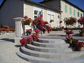
Town hall and school | |
 Pressignac | |
|
Location within Nouvelle-Aquitaine region  Pressignac | |
| Coordinates: 45°49′36″N 0°44′38″E / 45.8267°N 0.7439°ECoordinates: 45°49′36″N 0°44′38″E / 45.8267°N 0.7439°E | |
| Country | France |
| Region | Nouvelle-Aquitaine |
| Department | Charente |
| Arrondissement | Confolens |
| Canton | Chabanais |
| Intercommunality | Haute-Charente |
| Government | |
| • Mayor (2008–2014) | Maurice Faure |
| Area1 | 28.15 km2 (10.87 sq mi) |
| Population (2008)2 | 428 |
| • Density | 15/km2 (39/sq mi) |
| Time zone | CET (UTC+1) |
| • Summer (DST) | CEST (UTC+2) |
| INSEE/Postal code | 16270 / 16150 |
| Elevation |
163–282 m (535–925 ft) (avg. 264 m or 866 ft) |
|
1 French Land Register data, which excludes lakes, ponds, glaciers > 1 km² (0.386 sq mi or 247 acres) and river estuaries. 2 Population without double counting: residents of multiple communes (e.g., students and military personnel) only counted once. | |
Pressignac is a commune in the Charente department in southwestern France.
Population
| Historical population | ||
|---|---|---|
| Year | Pop. | ±% |
| 1793 | 1,304 | — |
| 1800 | 1,669 | +28.0% |
| 1806 | 1,056 | −36.7% |
| 1821 | 1,198 | +13.4% |
| 1831 | 1,277 | +6.6% |
| 1841 | 1,446 | +13.2% |
| 1846 | 1,504 | +4.0% |
| 1851 | 1,511 | +0.5% |
| 1856 | 1,463 | −3.2% |
| 1861 | 1,409 | −3.7% |
| 1866 | 1,470 | +4.3% |
| 1872 | 1,366 | −7.1% |
| 1876 | 1,315 | −3.7% |
| 1881 | 1,362 | +3.6% |
| 1886 | 1,434 | +5.3% |
| 1891 | 1,509 | +5.2% |
| 1896 | 1,504 | −0.3% |
| 1901 | 1,515 | +0.7% |
| 1906 | 1,525 | +0.7% |
| 1911 | 1,354 | −11.2% |
| 1921 | 1,178 | −13.0% |
| 1926 | 1,109 | −5.9% |
| 1931 | 1,041 | −6.1% |
| 1936 | 1,010 | −3.0% |
| 1946 | 934 | −7.5% |
| 1954 | 790 | −15.4% |
| 1962 | 781 | −1.1% |
| 1968 | 665 | −14.9% |
| 1975 | 577 | −13.2% |
| 1982 | 519 | −10.1% |
| 1990 | 477 | −8.1% |
| 1999 | 449 | −5.9% |
| 2008 | 428 | −4.7% |
See also
References
| Wikimedia Commons has media related to Pressignac. |
This article is issued from Wikipedia - version of the 2/23/2013. The text is available under the Creative Commons Attribution/Share Alike but additional terms may apply for the media files.