Verneuil, Charente
| Verneuil | |
|---|---|
|
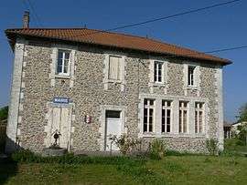
Town hall | |
 Verneuil | |
|
Location within Nouvelle-Aquitaine region  Verneuil | |
| Coordinates: 45°46′56″N 0°41′43″E / 45.7822°N 0.6953°ECoordinates: 45°46′56″N 0°41′43″E / 45.7822°N 0.6953°E | |
| Country | France |
| Region | Nouvelle-Aquitaine |
| Department | Charente |
| Arrondissement | Confolens |
| Canton | Montembœuf |
| Government | |
| • Mayor (2008–2014) | Camille Rassat |
| Area1 | 7.70 km2 (2.97 sq mi) |
| Population (2008)2 | 101 |
| • Density | 13/km2 (34/sq mi) |
| Time zone | CET (UTC+1) |
| • Summer (DST) | CEST (UTC+2) |
| INSEE/Postal code | 16398 / 16310 |
| Elevation |
217–298 m (712–978 ft) (avg. 270 m or 890 ft) |
|
1 French Land Register data, which excludes lakes, ponds, glaciers > 1 km² (0.386 sq mi or 247 acres) and river estuaries. 2 Population without double counting: residents of multiple communes (e.g., students and military personnel) only counted once. | |
Verneuil is a commune in the Charente department in southwestern France.
Population
| Historical population | ||
|---|---|---|
| Year | Pop. | ±% |
| 1793 | 274 | — |
| 1800 | 144 | −47.4% |
| 1806 | 246 | +70.8% |
| 1821 | 450 | +82.9% |
| 1831 | 343 | −23.8% |
| 1841 | 308 | −10.2% |
| 1846 | 335 | +8.8% |
| 1851 | 360 | +7.5% |
| 1856 | 342 | −5.0% |
| 1861 | 316 | −7.6% |
| 1866 | 332 | +5.1% |
| 1872 | 322 | −3.0% |
| 1876 | 337 | +4.7% |
| 1881 | 335 | −0.6% |
| 1886 | 323 | −3.6% |
| 1891 | 314 | −2.8% |
| 1896 | 314 | +0.0% |
| 1901 | 336 | +7.0% |
| 1906 | 324 | −3.6% |
| 1911 | 310 | −4.3% |
| 1921 | 260 | −16.1% |
| 1926 | 264 | +1.5% |
| 1931 | 260 | −1.5% |
| 1936 | 238 | −8.5% |
| 1946 | 210 | −11.8% |
| 1954 | 192 | −8.6% |
| 1962 | 168 | −12.5% |
| 1968 | 137 | −18.5% |
| 1975 | 121 | −11.7% |
| 1982 | 105 | −13.2% |
| 1990 | 102 | −2.9% |
| 1999 | 85 | −16.7% |
| 2008 | 101 | +18.8% |
See also
References
| Wikimedia Commons has media related to Verneuil (Charente). |
This article is issued from Wikipedia - version of the 7/20/2016. The text is available under the Creative Commons Attribution/Share Alike but additional terms may apply for the media files.