Dirac, Charente
For other uses, see Dirac (disambiguation).
| Dirac | |
|---|---|
 | |
 Dirac | |
|
Location within Nouvelle-Aquitaine region  Dirac | |
| Coordinates: 45°36′19″N 0°14′57″E / 45.6053°N 0.2492°ECoordinates: 45°36′19″N 0°14′57″E / 45.6053°N 0.2492°E | |
| Country | France |
| Region | Nouvelle-Aquitaine |
| Department | Charente |
| Arrondissement | Angoulême |
| Canton | Soyaux |
| Intercommunality | Vallée de l'Échelle |
| Government | |
| • Mayor (2008–2014) | Alain Thomas |
| Area1 | 29.29 km2 (11.31 sq mi) |
| Population (2008)2 | 1,473 |
| • Density | 50/km2 (130/sq mi) |
| Time zone | CET (UTC+1) |
| • Summer (DST) | CEST (UTC+2) |
| INSEE/Postal code | 16120 / 16410 |
| Elevation |
65–183 m (213–600 ft) (avg. 148 m or 486 ft) |
|
1 French Land Register data, which excludes lakes, ponds, glaciers > 1 km² (0.386 sq mi or 247 acres) and river estuaries. 2 Population without double counting: residents of multiple communes (e.g., students and military personnel) only counted once. | |
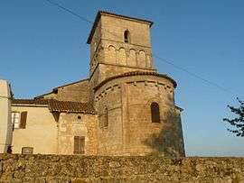
Dirac is a commune in the Charente department in the Nouvelle-Aquitaine region in southwestern France.
Population
| Historical population | ||
|---|---|---|
| Year | Pop. | ±% |
| 1962 | 538 | — |
| 1968 | 579 | +7.6% |
| 1975 | 807 | +39.4% |
| 1982 | 1,037 | +28.5% |
| 1990 | 1,260 | +21.5% |
| 1999 | 1,328 | +5.4% |
| 2008 | 1,473 | +10.9% |
See also
References
External links
| Wikimedia Commons has media related to Dirac (Charente). |
This article is issued from Wikipedia - version of the 11/11/2016. The text is available under the Creative Commons Attribution/Share Alike but additional terms may apply for the media files.