Châteaubernard
| Châteaubernard | ||
|---|---|---|
|
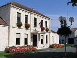
Town hall | ||
| ||
 Châteaubernard | ||
|
Location within Nouvelle-Aquitaine region  Châteaubernard | ||
| Coordinates: 45°40′24″N 0°18′47″W / 45.6733°N 0.3131°WCoordinates: 45°40′24″N 0°18′47″W / 45.6733°N 0.3131°W | ||
| Country | France | |
| Region | Nouvelle-Aquitaine | |
| Department | Charente | |
| Arrondissement | Cognac | |
| Canton | Cognac-Sud | |
| Intercommunality | Cognac | |
| Government | ||
| • Mayor (2008–2014) | Daniel Boyer | |
| Area1 | 13.31 km2 (5.14 sq mi) | |
| Population (2008)2 | 3,899 | |
| • Density | 290/km2 (760/sq mi) | |
| Time zone | CET (UTC+1) | |
| • Summer (DST) | CEST (UTC+2) | |
| INSEE/Postal code | 16089 / 16100 | |
| Elevation |
7–53 m (23–174 ft) (avg. 40 m or 130 ft) | |
|
1 French Land Register data, which excludes lakes, ponds, glaciers > 1 km² (0.386 sq mi or 247 acres) and river estuaries. 2 Population without double counting: residents of multiple communes (e.g., students and military personnel) only counted once. | ||
.svg.png)
Châteaubernard is a commune in the Charente department in southwestern France.
Population
| Historical population | ||
|---|---|---|
| Year | Pop. | ±% |
| 1793 | 252 | — |
| 1800 | 264 | +4.8% |
| 1806 | 250 | −5.3% |
| 1821 | 261 | +4.4% |
| 1831 | 305 | +16.9% |
| 1841 | 314 | +3.0% |
| 1872 | 898 | +186.0% |
| 1876 | 982 | +9.4% |
| 1881 | 914 | −6.9% |
| 1886 | 1,023 | +11.9% |
| 1891 | 1,140 | +11.4% |
| 1896 | 1,280 | +12.3% |
| 1901 | 1,408 | +10.0% |
| 1906 | 1,463 | +3.9% |
| 1911 | 1,462 | −0.1% |
| 1921 | 1,415 | −3.2% |
| 1926 | 1,437 | +1.6% |
| 1931 | 1,451 | +1.0% |
| 1936 | 1,383 | −4.7% |
| 1946 | 1,915 | +38.5% |
| 1954 | 2,869 | +49.8% |
| 1962 | 3,459 | +20.6% |
| 1968 | 3,486 | +0.8% |
| 1975 | 3,852 | +10.5% |
| 1982 | 3,957 | +2.7% |
| 1990 | 3,769 | −4.8% |
| 1999 | 3,536 | −6.2% |
| 2008 | 3,899 | +10.3% |
See also
Near Cognac Cognac, France
References
| Wikimedia Commons has media related to Châteaubernard. |
This article is issued from Wikipedia - version of the 6/19/2013. The text is available under the Creative Commons Attribution/Share Alike but additional terms may apply for the media files.