Fontenille
| Fontenille | |
|---|---|
|
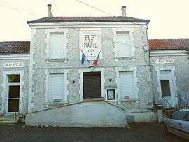
Town hall | |
 Fontenille | |
|
Location within Nouvelle-Aquitaine region  Fontenille | |
| Coordinates: 45°55′03″N 0°09′56″E / 45.9175°N 0.1656°ECoordinates: 45°55′03″N 0°09′56″E / 45.9175°N 0.1656°E | |
| Country | France |
| Region | Nouvelle-Aquitaine |
| Department | Charente |
| Arrondissement | Confolens |
| Canton | Mansle |
| Intercommunality | Pays Manslois |
| Government | |
| • Mayor (2008–2014) | Paul Fort |
| Area1 | 9.52 km2 (3.68 sq mi) |
| Population (2008)2 | 339 |
| • Density | 36/km2 (92/sq mi) |
| Time zone | CET (UTC+1) |
| • Summer (DST) | CEST (UTC+2) |
| INSEE/Postal code | 16141 / 16230 |
| Elevation |
55–128 m (180–420 ft) (avg. 126 m or 413 ft) |
|
1 French Land Register data, which excludes lakes, ponds, glaciers > 1 km² (0.386 sq mi or 247 acres) and river estuaries. 2 Population without double counting: residents of multiple communes (e.g., students and military personnel) only counted once. | |
Fontenille is a commune in the Charente department in southwestern France.
Population
| Historical population | ||
|---|---|---|
| Year | Pop. | ±% |
| 1793 | 577 | — |
| 1800 | 136 | −76.4% |
| 1806 | 125 | −8.1% |
| 1821 | 126 | +0.8% |
| 1831 | 129 | +2.4% |
| 1841 | 740 | +473.6% |
| 1846 | 796 | +7.6% |
| 1851 | 731 | −8.2% |
| 1856 | 738 | +1.0% |
| 1861 | 696 | −5.7% |
| 1866 | 669 | −3.9% |
| 1872 | 644 | −3.7% |
| 1876 | 608 | −5.6% |
| 1881 | 567 | −6.7% |
| 1886 | 538 | −5.1% |
| 1891 | 514 | −4.5% |
| 1896 | 470 | −8.6% |
| 1901 | 472 | +0.4% |
| 1906 | 449 | −4.9% |
| 1911 | 446 | −0.7% |
| 1921 | 408 | −8.5% |
| 1926 | 424 | +3.9% |
| 1931 | 410 | −3.3% |
| 1936 | 388 | −5.4% |
| 1946 | 386 | −0.5% |
| 1954 | 369 | −4.4% |
| 1962 | 353 | −4.3% |
| 1968 | 327 | −7.4% |
| 1975 | 346 | +5.8% |
| 1982 | 313 | −9.5% |
| 1990 | 335 | +7.0% |
| 1999 | 334 | −0.3% |
| 2008 | 339 | +1.5% |
See also
References
| Wikimedia Commons has media related to Fontenille (Charente). |
This article is issued from Wikipedia - version of the 7/16/2016. The text is available under the Creative Commons Attribution/Share Alike but additional terms may apply for the media files.