Oriolles
| Oriolles | |
|---|---|
|
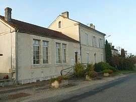
Town hall | |
 Oriolles | |
|
Location within Nouvelle-Aquitaine region  Oriolles | |
| Coordinates: 45°21′42″N 0°07′34″W / 45.3617°N 0.1261°WCoordinates: 45°21′42″N 0°07′34″W / 45.3617°N 0.1261°W | |
| Country | France |
| Region | Nouvelle-Aquitaine |
| Department | Charente |
| Arrondissement | Cognac |
| Canton | Brossac |
| Intercommunality | 3B - Sud-Charente |
| Government | |
| • Mayor (2008–2014) | Alain Bize |
| Area1 | 18.30 km2 (7.07 sq mi) |
| Population (2008)2 | 247 |
| • Density | 13/km2 (35/sq mi) |
| Time zone | CET (UTC+1) |
| • Summer (DST) | CEST (UTC+2) |
| INSEE/Postal code | 16251 / 16480 |
| Elevation |
84–162 m (276–531 ft) (avg. 106 m or 348 ft) |
|
1 French Land Register data, which excludes lakes, ponds, glaciers > 1 km² (0.386 sq mi or 247 acres) and river estuaries. 2 Population without double counting: residents of multiple communes (e.g., students and military personnel) only counted once. | |
Oriolles is a commune in the Charente department in southwestern France.
Population
| Historical population | ||
|---|---|---|
| Year | Pop. | ±% |
| 1793 | 385 | — |
| 1800 | 285 | −26.0% |
| 1806 | 311 | +9.1% |
| 1821 | 383 | +23.2% |
| 1831 | 475 | +24.0% |
| 1841 | 460 | −3.2% |
| 1846 | 481 | +4.6% |
| 1851 | 507 | +5.4% |
| 1856 | 512 | +1.0% |
| 1861 | 465 | −9.2% |
| 1866 | 450 | −3.2% |
| 1872 | 442 | −1.8% |
| 1876 | 446 | +0.9% |
| 1881 | 461 | +3.4% |
| 1886 | 444 | −3.7% |
| 1891 | 394 | −11.3% |
| 1896 | 375 | −4.8% |
| 1901 | 379 | +1.1% |
| 1906 | 384 | +1.3% |
| 1911 | 398 | +3.6% |
| 1921 | 356 | −10.6% |
| 1926 | 349 | −2.0% |
| 1931 | 358 | +2.6% |
| 1936 | 353 | −1.4% |
| 1946 | 290 | −17.8% |
| 1954 | 311 | +7.2% |
| 1962 | 283 | −9.0% |
| 1968 | 264 | −6.7% |
| 1975 | 218 | −17.4% |
| 1982 | 222 | +1.8% |
| 1990 | 223 | +0.5% |
| 1999 | 219 | −1.8% |
| 2008 | 247 | +12.8% |
See also
References
| Wikimedia Commons has media related to Oriolles. |
This article is issued from Wikipedia - version of the 7/2/2016. The text is available under the Creative Commons Attribution/Share Alike but additional terms may apply for the media files.