Taponnat-Fleurignac
| Taponnat-Fleurignac | |
|---|---|
|
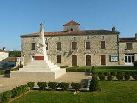
Town hall | |
 Taponnat-Fleurignac | |
|
Location within Nouvelle-Aquitaine region  Taponnat-Fleurignac | |
| Coordinates: 45°46′47″N 0°24′35″E / 45.7797°N 0.4097°ECoordinates: 45°46′47″N 0°24′35″E / 45.7797°N 0.4097°E | |
| Country | France |
| Region | Nouvelle-Aquitaine |
| Department | Charente |
| Arrondissement | Angoulême |
| Canton | La Rochefoucauld |
| Intercommunality | Bandiat-Tardoire |
| Government | |
| • Mayor (2008–2014) | Serge Jacob-Juin |
| Area1 | 21.49 km2 (8.30 sq mi) |
| Population (2008)2 | 1,458 |
| • Density | 68/km2 (180/sq mi) |
| Time zone | CET (UTC+1) |
| • Summer (DST) | CEST (UTC+2) |
| INSEE/Postal code | 16379 / 16110 |
| Elevation |
85–158 m (279–518 ft) (avg. 97 m or 318 ft) |
|
1 French Land Register data, which excludes lakes, ponds, glaciers > 1 km² (0.386 sq mi or 247 acres) and river estuaries. 2 Population without double counting: residents of multiple communes (e.g., students and military personnel) only counted once. | |
Taponnat-Fleurignac is a commune in the Charente department in southwestern France.
Population
| Historical population | ||
|---|---|---|
| Year | Pop. | ±% |
| 1793 | 530 | — |
| 1800 | 551 | +4.0% |
| 1806 | 556 | +0.9% |
| 1821 | 561 | +0.9% |
| 1831 | 702 | +25.1% |
| 1841 | 899 | +28.1% |
| 1846 | 1,013 | +12.7% |
| 1851 | 922 | −9.0% |
| 1856 | 932 | +1.1% |
| 1861 | 905 | −2.9% |
| 1866 | 914 | +1.0% |
| 1872 | 840 | −8.1% |
| 1876 | 891 | +6.1% |
| 1881 | 893 | +0.2% |
| 1886 | 948 | +6.2% |
| 1891 | 890 | −6.1% |
| 1896 | 822 | −7.6% |
| 1901 | 835 | +1.6% |
| 1906 | 871 | +4.3% |
| 1911 | 864 | −0.8% |
| 1921 | 794 | −8.1% |
| 1926 | 788 | −0.8% |
| 1931 | 858 | +8.9% |
| 1936 | 810 | −5.6% |
| 1946 | 774 | −4.4% |
| 1954 | 776 | +0.3% |
| 1962 | 883 | +13.8% |
| 1968 | 890 | +0.8% |
| 1975 | 1,048 | +17.8% |
| 1982 | 1,055 | +0.7% |
| 1990 | 1,175 | +11.4% |
| 1999 | 1,193 | +1.5% |
| 2008 | 1,458 | +22.2% |
See also
References
| Wikimedia Commons has media related to Taponnat-Fleurignac. |
This article is issued from Wikipedia - version of the 2/18/2016. The text is available under the Creative Commons Attribution/Share Alike but additional terms may apply for the media files.