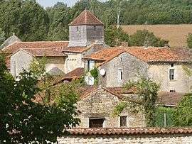
Poursac
| Poursac | |
|---|---|
 | |
 Poursac | |
|
Location within Nouvelle-Aquitaine region  Poursac | |
| Coordinates: 45°57′41″N 0°15′34″E / 45.9614°N 0.2594°ECoordinates: 45°57′41″N 0°15′34″E / 45.9614°N 0.2594°E | |
| Country | France |
| Region | Nouvelle-Aquitaine |
| Department | Charente |
| Arrondissement | Confolens |
| Canton | Ruffec |
| Intercommunality | Trois Vallées |
| Government | |
| • Mayor (2008–2014) | Anne-Marie Cormenier |
| Area1 | 11.39 km2 (4.40 sq mi) |
| Population (2008)2 | 207 |
| • Density | 18/km2 (47/sq mi) |
| Time zone | CET (UTC+1) |
| • Summer (DST) | CEST (UTC+2) |
| INSEE/Postal code | 16268 / 16700 |
| Elevation |
70–139 m (230–456 ft) (avg. 75 m or 246 ft) |
|
1 French Land Register data, which excludes lakes, ponds, glaciers > 1 km² (0.386 sq mi or 247 acres) and river estuaries. 2 Population without double counting: residents of multiple communes (e.g., students and military personnel) only counted once. | |
Poursac is a commune in the Charente department in southwestern France.
Population
| Historical population | ||
|---|---|---|
| Year | Pop. | ±% |
| 1793 | 443 | — |
| 1800 | 545 | +23.0% |
| 1806 | 575 | +5.5% |
| 1821 | 648 | +12.7% |
| 1831 | 668 | +3.1% |
| 1841 | 669 | +0.1% |
| 1846 | 654 | −2.2% |
| 1851 | 675 | +3.2% |
| 1856 | 681 | +0.9% |
| 1861 | 671 | −1.5% |
| 1866 | 640 | −4.6% |
| 1872 | 640 | +0.0% |
| 1876 | 628 | −1.9% |
| 1881 | 647 | +3.0% |
| 1886 | 621 | −4.0% |
| 1891 | 614 | −1.1% |
| 1896 | 537 | −12.5% |
| 1901 | 500 | −6.9% |
| 1906 | 508 | +1.6% |
| 1911 | 507 | −0.2% |
| 1921 | 426 | −16.0% |
| 1926 | 402 | −5.6% |
| 1931 | 403 | +0.2% |
| 1936 | 380 | −5.7% |
| 1946 | 385 | +1.3% |
| 1954 | 321 | −16.6% |
| 1962 | 294 | −8.4% |
| 1968 | 264 | −10.2% |
| 1975 | 258 | −2.3% |
| 1982 | 241 | −6.6% |
| 1990 | 222 | −7.9% |
| 1999 | 210 | −5.4% |
| 2008 | 207 | −1.4% |
See also
References
| Wikimedia Commons has media related to Poursac. |
This article is issued from Wikipedia - version of the 2/22/2013. The text is available under the Creative Commons Attribution/Share Alike but additional terms may apply for the media files.