Nanclars
| Nanclars | |
|---|---|
|
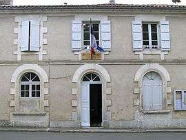
Town hall | |
 Nanclars | |
|
Location within Nouvelle-Aquitaine region  Nanclars | |
| Coordinates: 45°50′43″N 0°13′14″E / 45.8453°N 0.2206°ECoordinates: 45°50′43″N 0°13′14″E / 45.8453°N 0.2206°E | |
| Country | France |
| Region | Nouvelle-Aquitaine |
| Department | Charente |
| Arrondissement | Angoulême |
| Canton | Saint-Amant-de-Boixe |
| Intercommunality | Pays Manslois |
| Government | |
| • Mayor (2008–2014) | Olivier Fleuraud |
| Area1 | 5.73 km2 (2.21 sq mi) |
| Population (2008)2 | 206 |
| • Density | 36/km2 (93/sq mi) |
| Time zone | CET (UTC+1) |
| • Summer (DST) | CEST (UTC+2) |
| INSEE/Postal code | 16241 / 16230 |
| Elevation |
65–119 m (213–390 ft) (avg. 100 m or 330 ft) |
|
1 French Land Register data, which excludes lakes, ponds, glaciers > 1 km² (0.386 sq mi or 247 acres) and river estuaries. 2 Population without double counting: residents of multiple communes (e.g., students and military personnel) only counted once. | |
Nanclars is a commune in the Charente department in southwestern France.
Population
| Historical population | ||
|---|---|---|
| Year | Pop. | ±% |
| 1800 | 566 | — |
| 1806 | 578 | +2.1% |
| 1821 | 600 | +3.8% |
| 1831 | 583 | −2.8% |
| 1841 | 552 | −5.3% |
| 1846 | 584 | +5.8% |
| 1851 | 584 | +0.0% |
| 1856 | 555 | −5.0% |
| 1861 | 491 | −11.5% |
| 1866 | 488 | −0.6% |
| 1872 | 429 | −12.1% |
| 1876 | 474 | +10.5% |
| 1881 | 501 | +5.7% |
| 1886 | 450 | −10.2% |
| 1891 | 350 | −22.2% |
| 1896 | 405 | +15.7% |
| 1901 | 348 | −14.1% |
| 1906 | 391 | +12.4% |
| 1911 | 348 | −11.0% |
| 1921 | 245 | −29.6% |
| 1926 | 241 | −1.6% |
| 1931 | 216 | −10.4% |
| 1936 | 220 | +1.9% |
| 1946 | 200 | −9.1% |
| 1954 | 170 | −15.0% |
| 1962 | 209 | +22.9% |
| 1968 | 204 | −2.4% |
| 1975 | 186 | −8.8% |
| 1982 | 194 | +4.3% |
| 1990 | 201 | +3.6% |
| 1999 | 200 | −0.5% |
| 2008 | 206 | +3.0% |
See also
References
| Wikimedia Commons has media related to Nanclars. |
This article is issued from Wikipedia - version of the 2/11/2016. The text is available under the Creative Commons Attribution/Share Alike but additional terms may apply for the media files.