Bonnes, Charente
| Bonnes | ||
|---|---|---|
 | ||
| ||
 Bonnes | ||
|
Location within Nouvelle-Aquitaine region  Bonnes | ||
| Coordinates: 45°14′28″N 0°09′02″E / 45.2411°N 0.1506°ECoordinates: 45°14′28″N 0°09′02″E / 45.2411°N 0.1506°E | ||
| Country | France | |
| Region | Nouvelle-Aquitaine | |
| Department | Charente | |
| Arrondissement | Angoulême | |
| Canton | Aubeterre-sur-Dronne | |
| Intercommunality | Pays d'Aubeterre | |
| Government | ||
| • Mayor (2008–2014) | Stéphane Béguerie | |
| Area1 | 14.76 km2 (5.70 sq mi) | |
| Population (2008)2 | 360 | |
| • Density | 24/km2 (63/sq mi) | |
| Time zone | CET (UTC+1) | |
| • Summer (DST) | CEST (UTC+2) | |
| INSEE/Postal code | 16049 / 16390 | |
| Elevation |
32–136 m (105–446 ft) (avg. 30 m or 98 ft) | |
|
1 French Land Register data, which excludes lakes, ponds, glaciers > 1 km² (0.386 sq mi or 247 acres) and river estuaries. 2 Population without double counting: residents of multiple communes (e.g., students and military personnel) only counted once. | ||
.svg.png)
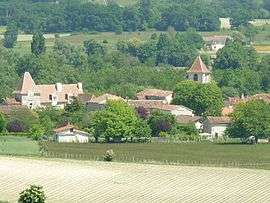
Bonnes is a commune in the Charente department in southwestern France.
Population
| Historical population | ||
|---|---|---|
| Year | Pop. | ±% |
| 1793 | 978 | — |
| 1800 | 960 | −1.8% |
| 1806 | 818 | −14.8% |
| 1821 | 995 | +21.6% |
| 1831 | 1,065 | +7.0% |
| 1841 | 1,026 | −3.7% |
| 1846 | 977 | −4.8% |
| 1851 | 964 | −1.3% |
| 1856 | 895 | −7.2% |
| 1861 | 882 | −1.5% |
| 1866 | 901 | +2.2% |
| 1872 | 809 | −10.2% |
| 1876 | 836 | +3.3% |
| 1881 | 810 | −3.1% |
| 1886 | 763 | −5.8% |
| 1891 | 744 | −2.5% |
| 1896 | 717 | −3.6% |
| 1901 | 659 | −8.1% |
| 1906 | 646 | −2.0% |
| 1911 | 655 | +1.4% |
| 1921 | 584 | −10.8% |
| 1926 | 549 | −6.0% |
| 1931 | 512 | −6.7% |
| 1936 | 502 | −2.0% |
| 1946 | 502 | +0.0% |
| 1954 | 482 | −4.0% |
| 1962 | 470 | −2.5% |
| 1968 | 448 | −4.7% |
| 1975 | 449 | +0.2% |
| 1982 | 362 | −19.4% |
| 1990 | 341 | −5.8% |
| 1999 | 333 | −2.3% |
| 2008 | 360 | +8.1% |
See also
References
External links
| Wikimedia Commons has media related to Bonnes (Charente). |
This article is issued from Wikipedia - version of the 11/13/2014. The text is available under the Creative Commons Attribution/Share Alike but additional terms may apply for the media files.