Anville, Charente
| Anville | |
|---|---|
|
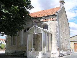
Town hall | |
 Anville | |
|
Location within Nouvelle-Aquitaine region  Anville | |
| Coordinates: 45°49′47″N 0°06′46″W / 45.8297°N 0.1128°WCoordinates: 45°49′47″N 0°06′46″W / 45.8297°N 0.1128°W | |
| Country | France |
| Region | Nouvelle-Aquitaine |
| Department | Charente |
| Arrondissement | Cognac |
| Canton | Rouillac |
| Intercommunality | Rouillacais |
| Government | |
| • Mayor (2008–2014) | Pascal Voudon |
| Area1 | 8.16 km2 (3.15 sq mi) |
| Population (2008)2 | 195 |
| • Density | 24/km2 (62/sq mi) |
| Time zone | CET (UTC+1) |
| • Summer (DST) | CEST (UTC+2) |
| INSEE/Postal code | 16017 / 16170 |
| Elevation |
93–152 m (305–499 ft) (avg. 180 m or 590 ft) |
|
1 French Land Register data, which excludes lakes, ponds, glaciers > 1 km² (0.386 sq mi or 247 acres) and river estuaries. 2 Population without double counting: residents of multiple communes (e.g., students and military personnel) only counted once. | |
Anville is a commune in the Charente department in southwestern France.
Population
| Historical population | ||
|---|---|---|
| Year | Pop. | ±% |
| 1793 | 403 | — |
| 1800 | 362 | −10.2% |
| 1806 | 447 | +23.5% |
| 1821 | 410 | −8.3% |
| 1831 | 478 | +16.6% |
| 1841 | 438 | −8.4% |
| 1846 | 423 | −3.4% |
| 1851 | 440 | +4.0% |
| 1856 | 443 | +0.7% |
| 1861 | 445 | +0.5% |
| 1866 | 443 | −0.4% |
| 1872 | 450 | +1.6% |
| 1876 | 431 | −4.2% |
| 1881 | 403 | −6.5% |
| 1886 | 349 | −13.4% |
| 1891 | 344 | −1.4% |
| 1896 | 306 | −11.0% |
| 1901 | 293 | −4.2% |
| 1906 | 292 | −0.3% |
| 1911 | 285 | −2.4% |
| 1921 | 270 | −5.3% |
| 1926 | 257 | −4.8% |
| 1931 | 252 | −1.9% |
| 1936 | 230 | −8.7% |
| 1946 | 219 | −4.8% |
| 1954 | 255 | +16.4% |
| 1962 | 226 | −11.4% |
| 1968 | 217 | −4.0% |
| 1975 | 181 | −16.6% |
| 1982 | 169 | −6.6% |
| 1990 | 173 | +2.4% |
| 1999 | 156 | −9.8% |
| 2008 | 105 | −32.7% |
See also
References
| Wikimedia Commons has media related to Anville. |
This article is issued from Wikipedia - version of the 2/22/2013. The text is available under the Creative Commons Attribution/Share Alike but additional terms may apply for the media files.