Coulonges, Charente
| Coulonges | |
|---|---|
|
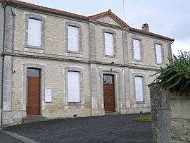
Town hall | |
 Coulonges | |
|
Location within Nouvelle-Aquitaine region  Coulonges | |
| Coordinates: 45°50′03″N 0°05′29″E / 45.8342°N 0.0914°ECoordinates: 45°50′03″N 0°05′29″E / 45.8342°N 0.0914°E | |
| Country | France |
| Region | Nouvelle-Aquitaine |
| Department | Charente |
| Arrondissement | Angoulême |
| Canton | Saint-Amant-de-Boixe |
| Intercommunality | Boixe |
| Government | |
| • Mayor (2008–2014) | Bruno Caffin |
| Area1 | 3.02 km2 (1.17 sq mi) |
| Population (2008)2 | 147 |
| • Density | 49/km2 (130/sq mi) |
| Time zone | CET (UTC+1) |
| • Summer (DST) | CEST (UTC+2) |
| INSEE/Postal code | 16108 / 16330 |
| Elevation |
53–124 m (174–407 ft) (avg. 100 m or 330 ft) |
|
1 French Land Register data, which excludes lakes, ponds, glaciers > 1 km² (0.386 sq mi or 247 acres) and river estuaries. 2 Population without double counting: residents of multiple communes (e.g., students and military personnel) only counted once. | |
Coulonges is a commune in the Charente department in southwestern France.
Population
| Historical population | ||
|---|---|---|
| Year | Pop. | ±% |
| 1793 | 320 | — |
| 1800 | 324 | +1.2% |
| 1806 | 334 | +3.1% |
| 1821 | 361 | +8.1% |
| 1831 | 335 | −7.2% |
| 1841 | 325 | −3.0% |
| 1846 | 331 | +1.8% |
| 1851 | 349 | +5.4% |
| 1856 | 298 | −14.6% |
| 1861 | 290 | −2.7% |
| 1866 | 298 | +2.8% |
| 1872 | 304 | +2.0% |
| 1876 | 258 | −15.1% |
| 1881 | 262 | +1.6% |
| 1886 | 236 | −9.9% |
| 1891 | 234 | −0.8% |
| 1896 | 200 | −14.5% |
| 1901 | 199 | −0.5% |
| 1906 | 206 | +3.5% |
| 1911 | 203 | −1.5% |
| 1921 | 175 | −13.8% |
| 1926 | 185 | +5.7% |
| 1931 | 159 | −14.1% |
| 1936 | 176 | +10.7% |
| 1946 | 162 | −8.0% |
| 1954 | 181 | +11.7% |
| 1962 | 200 | +10.5% |
| 1968 | 200 | +0.0% |
| 1975 | 176 | −12.0% |
| 1982 | 168 | −4.5% |
| 1990 | 135 | −19.6% |
| 1999 | 113 | −16.3% |
| 2008 | 147 | +30.1% |
See also
References
| Wikimedia Commons has media related to Coulonges (Charente). |
This article is issued from Wikipedia - version of the 2/22/2013. The text is available under the Creative Commons Attribution/Share Alike but additional terms may apply for the media files.