Palluaud
| Palluaud | |
|---|---|
 | |
 Palluaud | |
|
Location within Nouvelle-Aquitaine region  Palluaud | |
| Coordinates: 45°20′57″N 0°14′57″E / 45.3492°N 0.2492°ECoordinates: 45°20′57″N 0°14′57″E / 45.3492°N 0.2492°E | |
| Country | France |
| Region | Nouvelle-Aquitaine |
| Department | Charente |
| Arrondissement | Angoulême |
| Canton | Montmoreau-Saint-Cybard |
| Intercommunality | Montmorélien |
| Government | |
| • Mayor (2008–2014) | Marcel Lafaye |
| Area1 | 8.57 km2 (3.31 sq mi) |
| Population (2008)2 | 274 |
| • Density | 32/km2 (83/sq mi) |
| Time zone | CET (UTC+1) |
| • Summer (DST) | CEST (UTC+2) |
| INSEE/Postal code | 16254 / 16390 |
| Elevation |
57–191 m (187–627 ft) (avg. 50 m or 160 ft) |
|
1 French Land Register data, which excludes lakes, ponds, glaciers > 1 km² (0.386 sq mi or 247 acres) and river estuaries. 2 Population without double counting: residents of multiple communes (e.g., students and military personnel) only counted once. | |
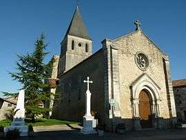
Palluaud is a commune in the Charente department in southwestern France.
Geography
The Lizonne forms the commune's eastern border.
Population
| Historical population | ||
|---|---|---|
| Year | Pop. | ±% |
| 1793 | 761 | — |
| 1800 | 560 | −26.4% |
| 1806 | 753 | +34.5% |
| 1821 | 726 | −3.6% |
| 1831 | 719 | −1.0% |
| 1841 | 662 | −7.9% |
| 1846 | 664 | +0.3% |
| 1851 | 702 | +5.7% |
| 1856 | 703 | +0.1% |
| 1861 | 688 | −2.1% |
| 1866 | 699 | +1.6% |
| 1872 | 620 | −11.3% |
| 1876 | 622 | +0.3% |
| 1881 | 547 | −12.1% |
| 1886 | 530 | −3.1% |
| 1891 | 518 | −2.3% |
| 1896 | 504 | −2.7% |
| 1901 | 455 | −9.7% |
| 1906 | 455 | +0.0% |
| 1911 | 427 | −6.2% |
| 1921 | 370 | −13.3% |
| 1926 | 352 | −4.9% |
| 1931 | 326 | −7.4% |
| 1936 | 328 | +0.6% |
| 1946 | 319 | −2.7% |
| 1954 | 268 | −16.0% |
| 1962 | 260 | −3.0% |
| 1968 | 264 | +1.5% |
| 1975 | 260 | −1.5% |
| 1982 | 273 | +5.0% |
| 1990 | 283 | +3.7% |
| 1999 | 290 | +2.5% |
| 2008 | 274 | −5.5% |
See also
References
| Wikimedia Commons has media related to Palluaud. |
This article is issued from Wikipedia - version of the 2/11/2016. The text is available under the Creative Commons Attribution/Share Alike but additional terms may apply for the media files.