Montrollet
| Montrollet | |
|---|---|
 | |
 Montrollet | |
|
Location within Nouvelle-Aquitaine region  Montrollet | |
| Coordinates: 45°59′01″N 0°53′51″E / 45.9836°N 0.8975°ECoordinates: 45°59′01″N 0°53′51″E / 45.9836°N 0.8975°E | |
| Country | France |
| Region | Nouvelle-Aquitaine |
| Department | Charente |
| Arrondissement | Confolens |
| Canton | Confolens-Sud |
| Intercommunality | Confolentais |
| Government | |
| • Mayor (2008–2014) | Jean-Claude Gillet |
| Area1 | 22.22 km2 (8.58 sq mi) |
| Population (2008)2 | 294 |
| • Density | 13/km2 (34/sq mi) |
| Time zone | CET (UTC+1) |
| • Summer (DST) | CEST (UTC+2) |
| INSEE/Postal code | 16231 / 16420 |
| Elevation |
225–366 m (738–1,201 ft) (avg. 366 m or 1,201 ft) |
|
1 French Land Register data, which excludes lakes, ponds, glaciers > 1 km² (0.386 sq mi or 247 acres) and river estuaries. 2 Population without double counting: residents of multiple communes (e.g., students and military personnel) only counted once. | |
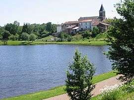
Montrollet is a commune in the Charente department in southwestern France.
Population
| Historical population | ||
|---|---|---|
| Year | Pop. | ±% |
| 1793 | 742 | — |
| 1800 | 594 | −19.9% |
| 1806 | 865 | +45.6% |
| 1821 | 873 | +0.9% |
| 1831 | 805 | −7.8% |
| 1841 | 757 | −6.0% |
| 1846 | 777 | +2.6% |
| 1851 | 770 | −0.9% |
| 1856 | 738 | −4.2% |
| 1861 | 700 | −5.1% |
| 1866 | 716 | +2.3% |
| 1872 | 678 | −5.3% |
| 1876 | 748 | +10.3% |
| 1881 | 752 | +0.5% |
| 1886 | 768 | +2.1% |
| 1891 | 793 | +3.3% |
| 1896 | 808 | +1.9% |
| 1901 | 841 | +4.1% |
| 1906 | 837 | −0.5% |
| 1911 | 797 | −4.8% |
| 1921 | 749 | −6.0% |
| 1926 | 706 | −5.7% |
| 1931 | 599 | −15.2% |
| 1936 | 585 | −2.3% |
| 1946 | 493 | −15.7% |
| 1954 | 485 | −1.6% |
| 1962 | 428 | −11.8% |
| 1968 | 406 | −5.1% |
| 1975 | 343 | −15.5% |
| 1982 | 296 | −13.7% |
| 1990 | 265 | −10.5% |
| 1999 | 269 | +1.5% |
| 2008 | 294 | +9.3% |
See also
References
| Wikimedia Commons has media related to Montrollet. |
This article is issued from Wikipedia - version of the 3/15/2016. The text is available under the Creative Commons Attribution/Share Alike but additional terms may apply for the media files.