Juillé, Charente
| Juillé | |
|---|---|
|
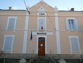
Town hall | |
 Juillé | |
|
Location within Nouvelle-Aquitaine region  Juillé | |
| Coordinates: 45°55′52″N 0°08′40″E / 45.9311°N 0.1444°ECoordinates: 45°55′52″N 0°08′40″E / 45.9311°N 0.1444°E | |
| Country | France |
| Region | Nouvelle-Aquitaine |
| Department | Charente |
| Arrondissement | Confolens |
| Canton | Mansle |
| Intercommunality | Pays Manslois |
| Government | |
| • Mayor (2008–2014) | Pascal Kaud |
| Area1 | 8.60 km2 (3.32 sq mi) |
| Population (2008)2 | 185 |
| • Density | 22/km2 (56/sq mi) |
| Time zone | CET (UTC+1) |
| • Summer (DST) | CEST (UTC+2) |
| INSEE/Postal code | 16173 / 16230 |
| Elevation |
56–116 m (184–381 ft) (avg. 116 m or 381 ft) |
|
1 French Land Register data, which excludes lakes, ponds, glaciers > 1 km² (0.386 sq mi or 247 acres) and river estuaries. 2 Population without double counting: residents of multiple communes (e.g., students and military personnel) only counted once. | |
Juillé is a commune in the Charente department in southwestern France.
Population
| Historical population | ||
|---|---|---|
| Year | Pop. | ±% |
| 1793 | 737 | — |
| 1800 | 777 | +5.4% |
| 1806 | 768 | −1.2% |
| 1821 | 800 | +4.2% |
| 1831 | 843 | +5.4% |
| 1841 | 811 | −3.8% |
| 1846 | 790 | −2.6% |
| 1851 | 779 | −1.4% |
| 1856 | 668 | −14.2% |
| 1861 | 650 | −2.7% |
| 1866 | 666 | +2.5% |
| 1872 | 643 | −3.5% |
| 1876 | 629 | −2.2% |
| 1881 | 596 | −5.2% |
| 1886 | 518 | −13.1% |
| 1891 | 489 | −5.6% |
| 1896 | 433 | −11.5% |
| 1901 | 393 | −9.2% |
| 1906 | 378 | −3.8% |
| 1911 | 361 | −4.5% |
| 1921 | 296 | −18.0% |
| 1926 | 306 | +3.4% |
| 1931 | 304 | −0.7% |
| 1936 | 294 | −3.3% |
| 1946 | 307 | +4.4% |
| 1954 | 288 | −6.2% |
| 1962 | 265 | −8.0% |
| 1968 | 232 | −12.5% |
| 1975 | 218 | −6.0% |
| 1982 | 206 | −5.5% |
| 1990 | 198 | −3.9% |
| 1999 | 181 | −8.6% |
| 2008 | 185 | +2.2% |
See also
References
| Wikimedia Commons has media related to Juillé (Charente). |
This article is issued from Wikipedia - version of the 2/22/2013. The text is available under the Creative Commons Attribution/Share Alike but additional terms may apply for the media files.