Montigné
| Montigné | |
|---|---|
|
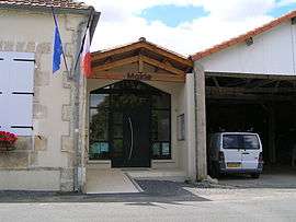
Town hall | |
 Montigné | |
|
Location within Nouvelle-Aquitaine region  Montigné | |
| Coordinates: 45°49′25″N 0°04′38″W / 45.8236°N 0.0772°WCoordinates: 45°49′25″N 0°04′38″W / 45.8236°N 0.0772°W | |
| Country | France |
| Region | Nouvelle-Aquitaine |
| Department | Charente |
| Arrondissement | Cognac |
| Canton | Rouillac |
| Intercommunality | Rouillacais |
| Government | |
| • Mayor (2008–2014) | Serge Devige |
| Area1 | 8.91 km2 (3.44 sq mi) |
| Population (2008)2 | 134 |
| • Density | 15/km2 (39/sq mi) |
| Time zone | CET (UTC+1) |
| • Summer (DST) | CEST (UTC+2) |
| INSEE/Postal code | 16228 / 16170 |
| Elevation |
78–170 m (256–558 ft) (avg. 140 m or 460 ft) |
|
1 French Land Register data, which excludes lakes, ponds, glaciers > 1 km² (0.386 sq mi or 247 acres) and river estuaries. 2 Population without double counting: residents of multiple communes (e.g., students and military personnel) only counted once. | |
Montigné is a commune in the Charente department in southwestern France.
Population
| Historical population | ||
|---|---|---|
| Year | Pop. | ±% |
| 1793 | 296 | — |
| 1800 | 296 | +0.0% |
| 1806 | 297 | +0.3% |
| 1821 | 341 | +14.8% |
| 1831 | 350 | +2.6% |
| 1841 | 392 | +12.0% |
| 1846 | 394 | +0.5% |
| 1851 | 355 | −9.9% |
| 1856 | 368 | +3.7% |
| 1861 | 342 | −7.1% |
| 1866 | 344 | +0.6% |
| 1872 | 335 | −2.6% |
| 1876 | 350 | +4.5% |
| 1881 | 288 | −17.7% |
| 1886 | 255 | −11.5% |
| 1891 | 225 | −11.8% |
| 1896 | 235 | +4.4% |
| 1901 | 227 | −3.4% |
| 1906 | 237 | +4.4% |
| 1911 | 227 | −4.2% |
| 1921 | 215 | −5.3% |
| 1926 | 210 | −2.3% |
| 1931 | 214 | +1.9% |
| 1936 | 204 | −4.7% |
| 1946 | 184 | −9.8% |
| 1954 | 170 | −7.6% |
| 1962 | 149 | −12.4% |
| 1968 | 158 | +6.0% |
| 1975 | 144 | −8.9% |
| 1982 | 122 | −15.3% |
| 1990 | 127 | +4.1% |
| 1999 | 112 | −11.8% |
| 2008 | 134 | +19.6% |
See also
References
| Wikimedia Commons has media related to Montigné. |
This article is issued from Wikipedia - version of the 2/22/2013. The text is available under the Creative Commons Attribution/Share Alike but additional terms may apply for the media files.