Montignac-Charente
| Montignac-Charente | ||
|---|---|---|
|
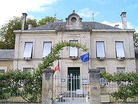
Town hall | ||
| ||
 Montignac-Charente | ||
|
Location within Nouvelle-Aquitaine region  Montignac-Charente | ||
| Coordinates: 45°47′03″N 0°07′32″E / 45.7842°N 0.1256°ECoordinates: 45°47′03″N 0°07′32″E / 45.7842°N 0.1256°E | ||
| Country | France | |
| Region | Nouvelle-Aquitaine | |
| Department | Charente | |
| Arrondissement | Angoulême | |
| Canton | Saint-Amant-de-Boixe | |
| Intercommunality | Boixe | |
| Government | ||
| • Mayor (2008–2014) | Claude Villéger | |
| Area1 | 8.63 km2 (3.33 sq mi) | |
| Population (2008)2 | 474 | |
| • Density | 55/km2 (140/sq mi) | |
| Time zone | CET (UTC+1) | |
| • Summer (DST) | CEST (UTC+2) | |
| INSEE/Postal code | 16226 / 16330 | |
| Elevation |
39–90 m (128–295 ft) (avg. 42 m or 138 ft) | |
|
1 French Land Register data, which excludes lakes, ponds, glaciers > 1 km² (0.386 sq mi or 247 acres) and river estuaries. 2 Population without double counting: residents of multiple communes (e.g., students and military personnel) only counted once. | ||
Montignac-Charente is a commune in the Charente department in southwestern France.
Population
| Historical population | ||
|---|---|---|
| Year | Pop. | ±% |
| 1793 | 482 | — |
| 1800 | 520 | +7.9% |
| 1806 | 531 | +2.1% |
| 1821 | 563 | +6.0% |
| 1831 | 693 | +23.1% |
| 1841 | 642 | −7.4% |
| 1846 | 702 | +9.3% |
| 1851 | 730 | +4.0% |
| 1856 | 690 | −5.5% |
| 1861 | 816 | +18.3% |
| 1866 | 733 | −10.2% |
| 1872 | 732 | −0.1% |
| 1876 | 773 | +5.6% |
| 1881 | 785 | +1.6% |
| 1886 | 778 | −0.9% |
| 1891 | 733 | −5.8% |
| 1896 | 629 | −14.2% |
| 1901 | 613 | −2.5% |
| 1906 | 554 | −9.6% |
| 1911 | 553 | −0.2% |
| 1921 | 441 | −20.3% |
| 1926 | 502 | +13.8% |
| 1931 | 518 | +3.2% |
| 1936 | 597 | +15.3% |
| 1946 | 529 | −11.4% |
| 1954 | 554 | +4.7% |
| 1962 | 568 | +2.5% |
| 1968 | 608 | +7.0% |
| 1975 | 709 | +16.6% |
| 1982 | 772 | +8.9% |
| 1990 | 709 | −8.2% |
| 1999 | 701 | −1.1% |
| 2008 | 474 | −32.4% |
See also
References
| Wikimedia Commons has media related to Montignac-Charente. |
This article is issued from Wikipedia - version of the 12/23/2015. The text is available under the Creative Commons Attribution/Share Alike but additional terms may apply for the media files.