Lagarde-sur-le-Né
| Lagarde-sur-le-Né | |
|---|---|
 | |
 Lagarde-sur-le-Né | |
|
Location within Nouvelle-Aquitaine region  Lagarde-sur-le-Né | |
| Coordinates: 45°30′44″N 0°12′10″W / 45.5122°N 0.2028°WCoordinates: 45°30′44″N 0°12′10″W / 45.5122°N 0.2028°W | |
| Country | France |
| Region | Nouvelle-Aquitaine |
| Department | Charente |
| Arrondissement | Cognac |
| Canton | Barbezieux-Saint-Hilaire |
| Intercommunality | 3B - Sud-Charente |
| Government | |
| • Mayor (2008–2014) | Serge Tapon |
| Area1 | 4.12 km2 (1.59 sq mi) |
| Population (2008)2 | 180 |
| • Density | 44/km2 (110/sq mi) |
| Time zone | CET (UTC+1) |
| • Summer (DST) | CEST (UTC+2) |
| INSEE/Postal code | 16178 / 16300 |
| Elevation |
30–68 m (98–223 ft) (avg. 49 m or 161 ft) |
|
1 French Land Register data, which excludes lakes, ponds, glaciers > 1 km² (0.386 sq mi or 247 acres) and river estuaries. 2 Population without double counting: residents of multiple communes (e.g., students and military personnel) only counted once. | |
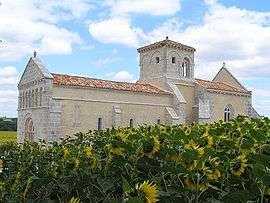
Lagarde-sur-le-Né is a commune in the Charente department in southwestern France.
Population
| Historical population | ||
|---|---|---|
| Year | Pop. | ±% |
| 1793 | 333 | — |
| 1800 | 343 | +3.0% |
| 1806 | 315 | −8.2% |
| 1821 | 328 | +4.1% |
| 1831 | 331 | +0.9% |
| 1841 | 389 | +17.5% |
| 1846 | 375 | −3.6% |
| 1851 | 356 | −5.1% |
| 1856 | 371 | +4.2% |
| 1861 | 341 | −8.1% |
| 1866 | 325 | −4.7% |
| 1872 | 327 | +0.6% |
| 1876 | 310 | −5.2% |
| 1881 | 292 | −5.8% |
| 1886 | 271 | −7.2% |
| 1891 | 251 | −7.4% |
| 1896 | 245 | −2.4% |
| 1901 | 253 | +3.3% |
| 1906 | 251 | −0.8% |
| 1911 | 236 | −6.0% |
| 1921 | 216 | −8.5% |
| 1926 | 240 | +11.1% |
| 1931 | 211 | −12.1% |
| 1936 | 190 | −10.0% |
| 1946 | 183 | −3.7% |
| 1954 | 181 | −1.1% |
| 1962 | 168 | −7.2% |
| 1968 | 164 | −2.4% |
| 1975 | 146 | −11.0% |
| 1982 | 169 | +15.8% |
| 1990 | 169 | +0.0% |
| 1999 | 174 | +3.0% |
| 2008 | 180 | +3.4% |
See also
References
| Wikimedia Commons has media related to Lagarde-sur-le-Né. |
This article is issued from Wikipedia - version of the 8/11/2013. The text is available under the Creative Commons Attribution/Share Alike but additional terms may apply for the media files.