Salles-de-Barbezieux
| Salles-de-Barbezieux | |
|---|---|
|
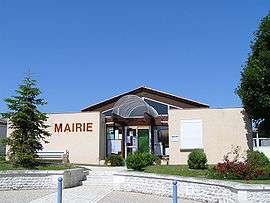
Town hall | |
 Salles-de-Barbezieux | |
|
Location within Nouvelle-Aquitaine region  Salles-de-Barbezieux | |
| Coordinates: 45°27′07″N 0°07′46″W / 45.4519°N 0.1294°WCoordinates: 45°27′07″N 0°07′46″W / 45.4519°N 0.1294°W | |
| Country | France |
| Region | Nouvelle-Aquitaine |
| Department | Charente |
| Arrondissement | Cognac |
| Canton | Barbezieux-Saint-Hilaire |
| Intercommunality | 3B - Sud-Charente |
| Government | |
| • Mayor (2008–2014) | Jean-Louis Nau |
| Area1 | 9.85 km2 (3.80 sq mi) |
| Population (2008)2 | 435 |
| • Density | 44/km2 (110/sq mi) |
| Time zone | CET (UTC+1) |
| • Summer (DST) | CEST (UTC+2) |
| INSEE/Postal code | 16360 / 16300 |
| Elevation |
48–99 m (157–325 ft) (avg. 85 m or 279 ft) |
|
1 French Land Register data, which excludes lakes, ponds, glaciers > 1 km² (0.386 sq mi or 247 acres) and river estuaries. 2 Population without double counting: residents of multiple communes (e.g., students and military personnel) only counted once. | |
Salles-de-Barbezieux is a commune in the Charente department in southwestern France.
Population
| Historical population | ||
|---|---|---|
| Year | Pop. | ±% |
| 1793 | 559 | — |
| 1800 | 504 | −9.8% |
| 1806 | 484 | −4.0% |
| 1821 | 533 | +10.1% |
| 1831 | 610 | +14.4% |
| 1841 | 580 | −4.9% |
| 1846 | 582 | +0.3% |
| 1851 | 575 | −1.2% |
| 1856 | 535 | −7.0% |
| 1861 | 508 | −5.0% |
| 1866 | 505 | −0.6% |
| 1872 | 464 | −8.1% |
| 1876 | 450 | −3.0% |
| 1881 | 406 | −9.8% |
| 1886 | 377 | −7.1% |
| 1891 | 339 | −10.1% |
| 1896 | 348 | +2.7% |
| 1901 | 339 | −2.6% |
| 1906 | 350 | +3.2% |
| 1911 | 354 | +1.1% |
| 1921 | 281 | −20.6% |
| 1926 | 299 | +6.4% |
| 1931 | 286 | −4.3% |
| 1936 | 288 | +0.7% |
| 1946 | 268 | −6.9% |
| 1954 | 280 | +4.5% |
| 1962 | 295 | +5.4% |
| 1968 | 271 | −8.1% |
| 1975 | 267 | −1.5% |
| 1982 | 317 | +18.7% |
| 1990 | 406 | +28.1% |
| 1999 | 408 | +0.5% |
| 2008 | 435 | +6.6% |
See also
References
| Wikimedia Commons has media related to Salles-de-Barbezieux. |
This article is issued from Wikipedia - version of the 2/25/2013. The text is available under the Creative Commons Attribution/Share Alike but additional terms may apply for the media files.