Saint-Georges, Charente
| Saint-Georges | |
|---|---|
|
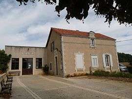
Town hall | |
 Saint-Georges | |
|
Location within Nouvelle-Aquitaine region  Saint-Georges | |
| Coordinates: 45°58′24″N 0°16′18″E / 45.9733°N 0.2717°ECoordinates: 45°58′24″N 0°16′18″E / 45.9733°N 0.2717°E | |
| Country | France |
| Region | Nouvelle-Aquitaine |
| Department | Charente |
| Arrondissement | Confolens |
| Canton | Ruffec |
| Intercommunality | Trois Vallées |
| Government | |
| • Mayor (2008–2014) | Gilbert Ballon |
| Area1 | 2.25 km2 (0.87 sq mi) |
| Population (2008)2 | 55 |
| • Density | 24/km2 (63/sq mi) |
| Time zone | CET (UTC+1) |
| • Summer (DST) | CEST (UTC+2) |
| INSEE/Postal code | 16321 / 16700 |
| Elevation |
76–125 m (249–410 ft) (avg. 122 m or 400 ft) |
|
1 French Land Register data, which excludes lakes, ponds, glaciers > 1 km² (0.386 sq mi or 247 acres) and river estuaries. 2 Population without double counting: residents of multiple communes (e.g., students and military personnel) only counted once. | |
Saint-Georges is a commune in the Charente department in southwestern France.
Population
| Historical population | ||
|---|---|---|
| Year | Pop. | ±% |
| 1793 | 118 | — |
| 1800 | 118 | +0.0% |
| 1806 | 133 | +12.7% |
| 1821 | 140 | +5.3% |
| 1831 | 133 | −5.0% |
| 1841 | 123 | −7.5% |
| 1846 | 132 | +7.3% |
| 1851 | 121 | −8.3% |
| 1856 | 150 | +24.0% |
| 1861 | 144 | −4.0% |
| 1866 | 144 | +0.0% |
| 1872 | 133 | −7.6% |
| 1876 | 135 | +1.5% |
| 1881 | 144 | +6.7% |
| 1886 | 135 | −6.2% |
| 1891 | 149 | +10.4% |
| 1896 | 140 | −6.0% |
| 1901 | 123 | −12.1% |
| 1906 | 143 | +16.3% |
| 1911 | 124 | −13.3% |
| 1921 | 109 | −12.1% |
| 1926 | 97 | −11.0% |
| 1931 | 88 | −9.3% |
| 1936 | 115 | +30.7% |
| 1946 | 93 | −19.1% |
| 1954 | 92 | −1.1% |
| 1962 | 82 | −10.9% |
| 1968 | 76 | −7.3% |
| 1975 | 73 | −3.9% |
| 1982 | 71 | −2.7% |
| 1990 | 75 | +5.6% |
| 1999 | 67 | −10.7% |
| 2008 | 55 | −17.9% |
See also
References
| Wikimedia Commons has media related to Saint-Georges (Charente). |
This article is issued from Wikipedia - version of the 3/15/2016. The text is available under the Creative Commons Attribution/Share Alike but additional terms may apply for the media files.