Pallikonda
| Pallikonda பள்ளிகொண்டா | |
|---|---|
| Town | |
|
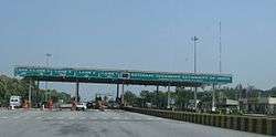
Pallikonda Toll Plaza on NH 46 | |
 Pallikonda Location in Tamil Nadu, India | |
| Coordinates: 12°55′00″N 78°56′00″E / 12.91667°N 78.93333°ECoordinates: 12°55′00″N 78°56′00″E / 12.91667°N 78.93333°E | |
| Country |
|
| State | Tamil Nadu |
| District | Vellore |
| Government | |
| • Type | Pallikonda Municipality |
| • Body | பள்ளிகொண்டா நகரம் |
| Area | |
| • Total | 19.2 km2 (7.4 sq mi) |
| Population (2011)[1] | |
| • Total | 43,067 |
| • Density | 2,200/km2 (5,800/sq mi) |
| Time zone | IST (UTC+5:30) |
| Vehicle registration | TN-23 |
Pallikonda is a Selection Grade Town Panchayat in Vellore district in the Indian state of Tamil Nadu. It Connects With 90 Villages And A Big Town : Gudiyatham
Demographics
As of 2001 India census,[2] Pallikonda had a population of 21,007. Males constitute 51% of the population and females 49%. Pallikonda has an average literacy rate of 73%, higher than the national average of 59.5%: male literacy is 80%, and female literacy is 66%. In Pallikonda, 11% of the population is under 6 years of age.
Transport
The town is well connected by road as it lies on the NH 46 of Bangalore-Chennai section which is part of the Golden Quadrilateral. A State Highway connects to Gudiyattam town[10 km]. The nearest railway station is Gudiyattam[6 km] on Chennai-Bangalore and Chennai-Coimbatore section of Southern Railway.
Geography
It lies roughly between IT hubs Chennai and Bengaluru. It is at a distance of 175 km from these two cities. Pallikonda has a tropical wet-and-dry climate, reaching high temperatures during summer and experiences wet winters. The maximum rainfall occurs during October and November, with the northeast monsoon. The area experiences rainfall during the southwest monsoon as well.
Due to its tropical and sub-tropical climate, mangoes, groundnuts, coconut and jasmine have been cultivated in and around the town for hundreds of years. on roads via National Highway 46 and on rails. The district headquarters, Vellore is about 21.6 km from the town towards Chennai. The proposed development of "Chennai-Bengaluru industrial corridor of excellence" is expected to stimulate the industrial growth which will improve the socio economic condition of the town.
Pallikonda experiences hot and dry weather throughout the year. The temperature ranges from a maximum of 43.5 °C (110.3 °F) to a minimum of 18.4 °C (65.1 °F). Like the rest of the state, April to June are the hottest months and December to January are the coldest. Pallikonda receives 996.7 mm (39.24 in) of rainfall every year. The southwest monsoon, with an onset in June and lasting up to August, brings scanty rainfall. The bulk of the rainfall is received during the northeast monsoon in October, November and December. The humidity ranges from 40%–63% during summer and 67%–86% during winter.[3]
| Climate data for Pallikonda | |||||||||||||
|---|---|---|---|---|---|---|---|---|---|---|---|---|---|
| Month | Jan | Feb | Mar | Apr | May | Jun | Jul | Aug | Sep | Oct | Nov | Dec | Year |
| Record high °C (°F) | 35.3 (95.5) |
39.8 (103.6) |
42.8 (109) |
44.4 (111.9) |
45.0 (113) |
44.3 (111.7) |
40.9 (105.6) |
39.4 (102.9) |
39.6 (103.3) |
39.2 (102.6) |
35.8 (96.4) |
35.0 (95) |
45.0 (113) |
| Average high °C (°F) | 29.2 (84.6) |
32.0 (89.6) |
35.0 (95) |
37.1 (98.8) |
38.5 (101.3) |
36.3 (97.3) |
34.6 (94.3) |
34.0 (93.2) |
34.0 (93.2) |
33.0 (91.4) |
29.5 (85.1) |
28.3 (82.9) |
33.46 (92.23) |
| Average low °C (°F) | 18.2 (64.8) |
19.2 (66.6) |
21.3 (70.3) |
24.8 (76.6) |
26.3 (79.3) |
26.0 (78.8) |
25.1 (77.2) |
24.6 (76.3) |
24.1 (75.4) |
22.9 (73.2) |
20.8 (69.4) |
19.2 (66.6) |
22.71 (72.88) |
| Record low °C (°F) | 10.2 (50.4) |
12.0 (53.6) |
12.1 (53.8) |
13.8 (56.8) |
18.1 (64.6) |
19.6 (67.3) |
18.8 (65.8) |
18.7 (65.7) |
18.7 (65.7) |
15.6 (60.1) |
12.1 (53.8) |
11.0 (51.8) |
10.2 (50.4) |
| Average precipitation mm (inches) | 9.0 (0.354) |
7.1 (0.28) |
5.9 (0.232) |
21.8 (0.858) |
83.9 (3.303) |
71.0 (2.795) |
117.0 (4.606) |
124.9 (4.917) |
149.6 (5.89) |
176.9 (6.965) |
155.2 (6.11) |
78.6 (3.094) |
1,000.9 (39.406) |
| Average precipitation days | 0.8 | 0.5 | 0.4 | 1.3 | 4.7 | 5.3 | 6.6 | 7.8 | 7.6 | 9.4 | 7.7 | 3.9 | 56 |
| Source: India Meteorological Department,[4] | |||||||||||||
Travels
1)P.G.S TRAVELS, pallikonda, Contact no:9443430180,9952458444,9944224451
Politics
The town falls under Anaicut Assembly Constituency and Vellore Lok Sabha seat in Tamil Nadu
Hospital
- DOCTOR SILUVAISITHAR
- AYURVEDA & HERBAL RESEARCH CENTRE
- CONTACT- 09443750929,+919080201077 & 09944401555
Government Hospital in Pallikonda
There is a Government (of Tamil Nadu state) Hospital in M.C Main Road, near Church and opposite to Government Boys Higher Secondary School. This hospital helps for its residents on general medicine, first aid care, pregnancy relief and so on. Government Hospital in Pallikonda serves for more than few decades for its nearby people.
Education In Pallikonda
There are two government higher secondary schools in Pallikonda one is at near town panchayat office and another one is at near ranganaadhar temple
- Govt boys Higher secondary School
- Girls Higher secondary School
- Shiksha kendra higher secondary school
- holy angels matric higher secondary school
- Sidhartha Nursery and primary School
- Breeze Nursery and primary school
- Mercy's Nursery and primary school
- Maligai school
- Anwar-ul-Islam school
- Aims Nursery and primary school
- yadhava school
- RCM high School
- LFC Aided school
- panchayat union Muslim School
- Sri saraswathi vidhayalaya Pallikonda
- Sri saraswathi vidhayalaya Vettuvanam
Colleges In Pallikonda
DR.Ambedkar College Social Development College, Pallikonda
Institution and Internet Cafe
- Arul Computers
- Arul Typewriting Institute
- Nest Internet Center
- Udhayas Internet Center
- Friends Internet Center
Temples
Located just under 25 km from Vellore off the Bangalore National Highway is the over 1000years old Ranganatha Perumal temple in Pallikonda seen in a Sayana Kolam as described by Periyazhvaar - 'படுத்த பைந்நாகனைப் பள்ளிகொண்டானுக்குப் பல்லாண்டு கூறுதுமே'. It is the first of the three temples where Lord Narayana presented himself in a Sayana Kolam to block the floods intended to disrupt Brahmma's Yagna.
Chelliamman festival is celebrated every year. karagam is very popular in this area.its taken by kanachari and family by names M.Dhandapani and Umapathi
Ellai Amman temple is presented in Vettuvanam area.
Also a great temple of Lord Muruga "VITHUGIRI VELAVAN TEMPLE" is situated at VITHU HILLS near toll plaza.
References
- ↑ "Census of India Search details". censusindia.gov.in. Retrieved 10 May 2015.
- ↑ "Census of India 2001: Data from the 2001 Census, including cities, villages and towns (Provisional)". Census Commission of India. Archived from the original on 2004-06-16. Retrieved 2008-11-01.
- ↑ "About city". Vellore municipal corporation. 2011. Retrieved 2012-12-29.
- ↑ "Climatological Information for Tirupattur,India". India Meteorological Department.