Atlantic Canada
| Atlantic Provinces Provinces de l'Atlantique (Fr) | |
| The Atlantic Provinces | |
| Region | |
| Country | |
|---|---|
| Provinces | |
| Area | 502,927 km2 (194,181 sq mi) [1] |
| Population | 2,327,638 (2011) [1] |
| Density | 5/km2 (13/sq mi) |
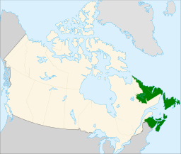 Atlantic Canada (green) within the rest of Canada (tan)
| |
Atlantic Canada is the region of Canada comprising the four provinces located on the Atlantic coast, excluding Quebec: the three Maritime provinces – New Brunswick, Prince Edward Island, and Nova Scotia – and the easternmost province of Newfoundland and Labrador. The population of the four Atlantic provinces in 2011 was about 2,300,000[2] on half a million km2.
History
The first Premier of Newfoundland, Joey Smallwood, coined the term "Atlantic Canada" when Newfoundland joined the Dominion of Canada in 1949. He believed that it would have been presumptuous for Newfoundland to assume that it could include itself within the existing term "Maritime Provinces", used to describe the cultural similarities shared by New Brunswick, Prince Edward Island, and Nova Scotia. The three Maritime provinces entered into confederation during the 19th century: New Brunswick and Nova Scotia were founding members of the Dominion of Canada in 1867, and Prince Edward Island joined in 1873. Today Atlantic Canada is a culturally distinct region of Canada, with the original founding cultures of Celtic, English and French remaining strong and vibrant to this day.
Although Quebec has physical Atlantic coasts on the Gulf of St. Lawrence, Ungava Bay, and the Hudson Strait, it is generally not considered an Atlantic Province.
Communities
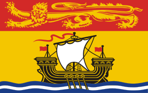
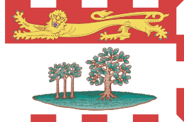
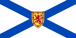
2011 census figures for "Metropolitan Areas" (broadest definition, includes entire municipalities and all commuter municipalities) and "Population Centres" (limited to actual continuously-built-up area) in Atlantic Canada. The list includes communities above 15,000, by Metropolitan Area population, or 10,000 by Population Centre population.[2]
| Community | Province | Population (Metropolitan) | Population (Pop. Centre) |
|---|---|---|---|
| Halifax | Nova Scotia | 390,328[3] | 297,943 |
| St. John's | Newfoundland and Labrador | 196,966[4] | 165,346 |
| Moncton | New Brunswick | 138,644[5] | 107,086 |
| Saint John | New Brunswick | 127,761[6] | 95,902 |
| Cape Breton | Nova Scotia | 101,619[7] | Sydney - 31,597 |
| Glace Bay - 19,076 | |||
| Sydney Mines - 14,135 | |||
| Fredericton | New Brunswick | 94,268[8] | 61,522 |
| Charlottetown | Prince Edward Island | 64,487[9] | 42,602 |
| Truro | Nova Scotia | 45,888[10] | 23,261 |
| New Glasgow | Nova Scotia | 35,809[11] | 20,609 |
| Bathurst | New Brunswick | 33,484[12] | 17,887 |
| Miramichi | New Brunswick | 28,115[13] | 13,307 |
| Corner Brook | Newfoundland and Labrador | 27,202[14] | 19,759 |
| Kentville | Nova Scotia | 26,359[15] | 14,234 |
| Edmundston | New Brunswick | 21,903[16] | 13,660 |
| Summerside | Prince Edward Island | 16,488[17] | 14,751 |
| Grand Falls-Windsor | Newfoundland and Labrador | 13,785[18] | 12,714 |
| Gander | Newfoundland and Labrador | 11,054[19] | 10,234 |
| Bay Roberts | Newfoundland and Labrador | 10,871[18] | 10,638 |
See also
- List of regions of Canada
- Acadiensis, scholarly history journal covering Atlantic Canada
References
- 1 2 "Population and dwelling counts, for Canada, provinces and territories, 2011 and 2006 censuses". Statistics Canada. 2012-01-24. Retrieved 2012-03-17.
- 1 2 "Population and dwelling counts, for Canada, provinces and territories, 2011 and 2006 censuses". Statistics Canada. Retrieved 16 February 2012.
- ↑ "List of Census Metropolitan Areas in Nova Scotia". Statistics Canada. Retrieved 16 July 2013.
- ↑ "Census Profile - St. John's". Statistics Canada. Retrieved 16 February 2012.
- ↑ "Census Profile - Moncton". Statistics Canada. Retrieved 16 February 2012.
- ↑ "Census Profile - Saint John". Statistics Canada. Retrieved 16 February 2012.
- ↑ "Census Profile - Cape Breton Regional Municipality". Statistics Canada. Retrieved 16 February 2012.
- ↑ "Census Profile - Fredericton". Statistics Canada. Retrieved 16 February 2012.
- ↑ "Census Profile - Charlottetown". Statistics Canada. Retrieved 16 February 2012.
- ↑ "Census Profile - Truro". Statistics Canada. Retrieved 16 February 2012.
- ↑ "Census Profile - New Glasgow". Statistics Canada. Retrieved 16 February 2012.
- ↑ "Census Profile - Bathurst". Statistics Canada. Retrieved 16 February 2012.
- ↑ "Census Profile - Miramichi". Statistics Canada. Retrieved 16 February 2012.
- ↑ "Census Profile - Corner Brook". Statistics Canada. Retrieved 16 February 2012.
- ↑ "Census Profile - Kentville". Statistics Canada. Retrieved 16 February 2012.
- ↑ "Census Profile - Edmundston". Statistics Canada. Retrieved 16 February 2012.
- ↑ "Census Profile - Summerside". Statistics Canada. Retrieved 16 February 2012.
- 1 2 "Population and dwelling counts, for Canada, provinces and territories, census metropolitan areas and census agglomerations, 2011 and 2006 censuses". Statistics Canada. Retrieved 15 November 2013.
- ↑ "Population and dwelling counts, for Canada and census subdivisions (municipalities) with 5,000-plus population, 2011 and 2006 censuses". Statistics Canada. Retrieved 15 November 2013.
Further reading
- Hamilton, William Baillie (1996), Place names of Atlantic Canada, University of Toronto Press, ISBN 0-8020-0471-7
- MacEachern, Alan Andrew (2001), Natural selections: national parks in Atlantic Canada, McGill-Queen's University Press, ISBN 0-7735-2157-7
- Martinez, Andrew J; Martinez, Candace Storm (2003), Marine Life of the North Atlantic: Canada to New England, Aqua Quest Publications, ISBN 1-881652-32-7
- Prieur, Benoit (2005), Atlantic Canada, Ulysse Travel Publ, ISBN 2894647239
External links
| Wikivoyage has a travel guide for Atlantic Provinces. |
| Look up Atlantic Canada in Wiktionary, the free dictionary. |
- Atlas of Canada - Atlantic Region
- Atlantic Canadian cities and Surrounding areas
- Atlantic Canada Portal/Portail du Canada Atlantique
- Atlantic Canada a Profitable Place to do Business
- Historical Coins of Atlantic Canada
- East Coast Proud
Coordinates: 47°N 62°W / 47°N 62°W