Khambhat
| Khambhat ખંભાત Cambay खंभात | |
|---|---|
| City | |
|
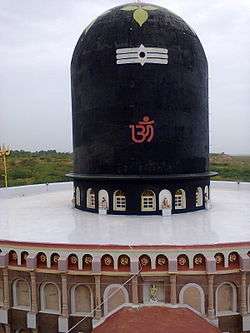
Shivling, Ralaj, Khambhat | |
| Nickname(s): Trambavati Nagari | |
 Khambhat | |
| Coordinates: 22°18′N 72°37′E / 22.3°N 72.62°ECoordinates: 22°18′N 72°37′E / 22.3°N 72.62°E | |
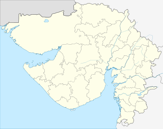
| Country | India |
| State | Gujarat |
| District | Anand |
| Government | |
| • Type | Nagar Palika |
| Area | |
| • Total | 2,932.9 km2 (1,132.4 sq mi) |
| Population (2011) | |
| • Total | 1,83,830 (M+OG) |
| • Density | 620/km2 (1,600/sq mi) |
| Languages | |
| • Official | Gujarati |
| Time zone | IST (UTC+5:30) |
| PIN | 388620,388625,388630,388540 |
| Telephone code | 02698 |
| Vehicle registration | GJ 23 |
| Website | www.khambhatnagarpalika.in |
Khambhat (Gujarati: ખંભાત, Hindi: खंभात(![]() pronunciation ), also known as Cambay, is a town and the surrounding urban agglomeration in Khambhat Taluka, Anand district in the Indian state of Gujarat.[1] It was once an important trading center, but its harbour gradually silted up, and the maritime trade moved elsewhere. Khambhat lies on an alluvial plain at the north end of the Gulf of Khambhat, noted for the extreme rise and fall of its tides, which can vary as much as thirty feet in the vicinity of Khambhat. Khambhat is known for its halvasan, sutarfeni and kites (patang). And though being a part of sources of oil and gas.
pronunciation ), also known as Cambay, is a town and the surrounding urban agglomeration in Khambhat Taluka, Anand district in the Indian state of Gujarat.[1] It was once an important trading center, but its harbour gradually silted up, and the maritime trade moved elsewhere. Khambhat lies on an alluvial plain at the north end of the Gulf of Khambhat, noted for the extreme rise and fall of its tides, which can vary as much as thirty feet in the vicinity of Khambhat. Khambhat is known for its halvasan, sutarfeni and kites (patang). And though being a part of sources of oil and gas.
Khambat is perhaps the only place in India, where the Harappan craft – the agate bead making is found in the living tradition. Surprisingly Khambat has no stone deposit. But the craft has survived mainly through acquiring stones from the Rajpipla hills, about 200 km away from the town. In the folklore of Khambat the beginning of the craft is attributed to Baba Ghor, a 1500 AD saint from Ethiopia who had led a large contingent of Muslims to settle in the town. However, in the archaeological record the origin of the craft can be traced to the nearby Lothal, a Harappan outpost flourished about 4000 years ago.
History


Cambay was formerly a flourishing city, the seat of an extensive trade, and celebrated for its manufactures of silk, chintz and gold stuffs. The Arab traveler al-Mas'udi visited the city in 915 AD, describing it as a very successful port; it was mentioned in 1293 by Marco Polo, who, calling it Cambaet, noted it as a busy port. He mentions that the city had its own king. Indigo and fine buckram were particular products of the region, but much cotton and leather was exported through Cambay. A contemporary Italian traveler, Marino Sanudo, said that Cambeth was one of India’s main two ocean ports. Another Italian, visiting in about 1440, Niccolò de' Conti, mentions that the walls of the city were twelve miles in circumference.
The Portuguese explorer Duarte Barbosa visited the city, which he calls Cambaia, in the early sixteenth century.[2] His description of the city is very full, he states:
"Entering by Cuindarim,[3] which is the internal river, there is great and beautiful city that they call Cambaia, populated by 'mouros' (Muslims) and 'gentios' (Hindus). It has many beautiful houses, very high with windows, and covered with tiles in our manner. The streets are laid out well, with pretty squares and large buildings."
He describes the city as very busy and affluent, with merchants coming frequently by sea from the world around.
Owing principally to the gradually increasing difficulty of access by water by the silting up of the gulf, its commerce has long since fallen away, and the town became poor and dilapidated. The spring tides rise upwards of 30 ft (10 m) and in a channel usually so shallow that it is a serious danger to shipping. By 1900, the trade was chiefly confined to the export of cotton. The town was celebrated for its manufacture of agate and carnelian ornaments, of reputation, principally in China.
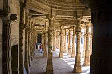
The houses in many instances are built of stone (a circumstance which indicates the former wealth of the city, as the material had to be brought from a very considerable distance); and remains of a brick wall, three miles (five km) in circumference, which formerly surrounded the town, enclose four large reservoirs of good water and three bazaars. To the southeast there are very extensive ruins of subterranean temples and other buildings half-buried in the sand by which the ancient town was overwhelmed. These temples belong to the Jains and contain two massive statues of their deities: one black, the other white. The principal one, as the inscription intimates, is Pariswanath or Parswanath, carved in the reign of the emperor Akbar; the black one has the date of 1651 inscribed.
Princely State of Cambay
Khambhat was the capital of Cambay State, a princely state of British India. It was the only state in the Kaira Agency of the Gujarat division of Bombay Presidency. It had an area of 350 square miles (906 km²). It was founded in 1730, at the time of the dismemberment of the Mughal Empire. Its Nawabs were descendents of Mumin Khan, the last of the Mughal governors of Gujarat who in 1742 defeated his brother-in-law Nizam Khan, governor of Khambhat, and established himself there.[4]
In 1780 Cambay was taken by the army of general Goddard Richards, but it was restored to the Marathas in 1783. Finally it was ceded to the British by the Peshwa under the treaty of 1803. The state was provided with a railway in 1901.
Geography
Khambhat is at 22°18′N 72°37′E / 22.3°N 72.62°E.[5] It has an average elevation of 8 metres (26 feet).
Khambhat has warm and humid climate. It is located on the plains. The land on which Khambhat sits is the silt deposited by Mahi river, so Khambhat has very fertile, wet coastal alluvial soil.The area south of Khambhat is muddy wetlands and then coast line comes. Normally April to June is summer. From July, it rains until September. It has muggy climate for most part of the year except winters. Sometimes Khambhat receives heavy rain. And sometimes surrounding areas gets affected from the floods in Mahi river. October to February is winter. max. average temperature remains 25 to 30 and min. average temperature goes until 10 to 12. Summer max. average temperature remains 38 and minimum remains around 22. In summer, wind blows high. Khambhat coast's tides are the highest in the world. It goes high up to 35 feet.[6]
Demographics
As of 2001 India census,[7] Khambhat had a population of 80,439. Males constitute 52% of the population and females 48%. Khambhat has an average literacy rate of 73%, higher than the national average of 59.5%: male literacy is 78%, and female literacy is 67%. In Khambhat, 10% of the population is under 6 years of age.
Economy
Mostly here the people have agate business, color stone business (mainly ruby) and have shops which sell eatables and household products.
Transport
Railway
Khambhat is Connected with Anand (district headquarter) by Railway Line. Total 8 trains departs per day for Anand.
Road
Khambhat is connected with Tarapur,Dharmaj,Vataman and Dali by Regional roads.
Schools
- Kendriya Vidyalaya O.N.G.C Cambay
- R.C. Mission School
- ST. Xavier's High School(Science+Common Stream)
- Madhavlal Shah High School
- S.Z. Vaghela High School(Science+Common Stream)
- S.K. Vaghela High School
- S.D. Kapadiya High School
- M.T. High School
- Metpur High School
- Supath High School
- Bits Education High School(Science Stream)
- Vatsalya International School
- Adarsh Saraswati Vidhya Mandir, NAGRA
- Jalsan highschool, JALSAN
- Harsh Balvatika, NANAKALODRA
- N.A.Patel Shishuvidhyalay, NANAKALODRA
- Chachaldeep Vidyavihar, NANAKALODRA
- SMT.K.M.J.PATEL HIGHSCHOOL,SAYAMA.(ARTS& COMMERCE)
- S.M.T. B.C.J.High School,JALUNDH.PIPLOI.
Colleges
- L.B. Rao Institute of Pharmaceutical Education
- Shri M N College of Pharmacy
- R.P.Arts, K.B.Commerce & B.C.J Science College
Tourism
- Sikotar Mata Mandir,Ralej
- Dariyai Uttarayn (Organized on first Sunday after Uttarayan at Seashore)
- Swaminarayan Mandir
- Jama Mosque
- Muharram of khambhat
Additional information
In May 2001, India's Union Minister for Human Resource Development, Science and Technology division, Murli Manohar Joshi, announced that the ruins of an ancient civilization had been discovered off the coast of Gujarat, in the Gulf of Khambhat. The site was discovered by NIOT while they performed routine pollution studies using sonar, and was described as an area of regularly spaced geometric structures. It is located 20 km from the Gujarat coast, spans 9 km, and can be found at a depth of 30–40 meters. In his announcement, Joshi represented the site as an urban settlement that pre-dates the Indus Valley Civilization. However, these claims were made without the backing of any experts and have since been debunked by prominent archaeologists. [8]
References
- ↑ "Alphabetical List of Towns and their Population: Gujarat" (PDF). Census of India 2011. Office of The Registrar General & Census Commissioner, Ministry of Home Affairs, Government of India. Archived (PDF) from the original on 24 November 2007.
- ↑ Livro em que dá relação do que viu e ouviu no Oriente. p. 77 sq.
- ↑ Is this internal river, the Cuindarim, the Narmada?
- ↑ Princely States of India
- ↑ Khambhat is between the tropical and subtropical climatic zone.Falling Rain Genomics, Inc – Khambhat
- ↑ A. S. Unnikrishnan, S. R. Shetye and G. S. Michael. "Tidal propagation in the Gulf of Khambhat, Bombay High, and surrounding areas". Journal of Earth System Science. 108 (3): 155–177.
- ↑ "Census of India 2001: Data from the 2001 Census, including cities, villages and towns (Provisional)". Census Commission of India. Archived from the original on 2004-06-16. Retrieved 2008-11-01.
- ↑ Bavadam, Lyla. "Questionable claims: Archaeologists debunk the claim that underwater structures in the Gulf of Khambhat point to the existence of a pre-Harappan civilisation." Frontline 2–15 March 2002. .
![]() This article incorporates text from a publication now in the public domain: Chisholm, Hugh, ed. (1911). "article name needed". Encyclopædia Britannica (11th ed.). Cambridge University Press.
This article incorporates text from a publication now in the public domain: Chisholm, Hugh, ed. (1911). "article name needed". Encyclopædia Britannica (11th ed.). Cambridge University Press.
External links
 Media related to Khambhat at Wikimedia Commons
|  | |||||||||||||||||||||||||||||||||||||||||||||||||||||||||||||||||||||||||
|
| ||||||||||||||||||||||||||||||||||||||||||||||||||||||||||||||||||||||||||
| ||||||||||||||||||||||||||||||||||||||||||||||||||||||||||||||||||||||||||
| ||||||||||||||||||||||||||||||||||||||||||||||||||||||||||||||||||||||||||
| ||||||||||||||||||||||||||||||||||||||||||||||||||||||||||||||||||||||||||
| ||||||||||||||||||||||||||||||||||||||||||||||||||||||||||||||||||||||||||