Van Buren, Missouri
| Van Buren, Missouri | |
|---|---|
| City | |
 Location of Van Buren, Missouri | |
| Coordinates: 37°0′13″N 91°0′55″W / 37.00361°N 91.01528°WCoordinates: 37°0′13″N 91°0′55″W / 37.00361°N 91.01528°W | |
| Country | United States |
| State | Missouri |
| County | Carter |
| Township | Carter |
| Area[1] | |
| • Total | 2.00 sq mi (5.18 km2) |
| • Land | 2.00 sq mi (5.18 km2) |
| • Water | 0 sq mi (0 km2) |
| Elevation | 472 ft (144 m) |
| Population (2010)[2] | |
| • Total | 819 |
| • Estimate (2012[3]) | 826 |
| • Density | 409.5/sq mi (158.1/km2) |
| Time zone | Central (CST) (UTC-6) |
| • Summer (DST) | CDT (UTC-5) |
| ZIP code | 63965 |
| Area code(s) | 573 |
| FIPS code | 29-75580[4] |
| GNIS feature ID | 0752687[5] |
Van Buren is a city that is the county seat of Carter County, Missouri, in the United States. It is the largest town in Carter County. Van Buren was founded in 1833 as the county seat of Ripley County and was named after then Vice President of the United States, Martin Van Buren. In 1859 Van Buren became a part of the newly created Carter County and was subsequently selected to be the county seat.[6] The 2010 U.S. Census shows Van Buren with a population of 819, a decrease of 3.1 percent from its 2000 population of 845.[7]
History
In 1833 a commission appointed for the purpose of choosing a site for the county seat of Ripley County selected a site one-half mile west and across Current River from the present location of Van Buren. They named the new county seat Van Buren after the then Vice President of the United States, Martin Van Buren. A court house was built and a small city grew up around it. The city had one small general merchandise store run by a man named Shaw and a water powered grist mill owned by John George.
Van Buren remained the county seat of Ripley County until 1847 when the county seat was moved south to the town of Doniphan. After the removal of the county seat to Doniphan the town declined until only three or four families remained.
On March 10, 1859 Van Buren became part of the newly created Carter County and a few days later on April 4, Van Buren was selected to be the county seat of Carter County.
In 1867 the present site of Van Buren, located about a half-mile east and across the river from the original site, was purchased from Zimri A. Carter. Fifty acres of land was purchased from Zimri A. Carter for $475 and the deed given to Carter County commissioner James Snider. The first building to be built, even before the new city site was fully laid out, was a log court house located somewhat west of the current court house.
In 1874 the Vidette, a newspaper published by Dr. McDonald, began a brief run of only a few months before it folded. In 1876 another newspaper, the Times, published by Tom Brown and James Moseley, was published until 1884 at which time it was merged with the Current Local, which was established by Clay Moseley that same year, and which is now Carter County’s only locally published newspaper.
In 1893-94 the first bridge to cross the Current River was built at Van Buren at a total cost of $4,500. It was a suspension bridge and a toll of 5 cents per person and 15 cents for a team and wagon was charged for crossing it.
In 1901 the Carter County Bank, later known as the Carter County State Bank was instituted in Van Buren.
In 1907 the company of Pitman and Henry began a motorboat passenger service up and down the Current River between Van Buren and Doniphan
Sometime after 1907 the lines of the Willow Springs Local Long Distance Phone Company reached Van Buren bringing phone service to Van Buren.
In 1909 a structural steel bridge was built across the Current River at a total cost of about $9,000. This bridge was destroyed by a flood in 1915. The bridge was rebuilt at a cost of $15,000 and served the community until 1926 when a new $200,000 bridge was completed. Route 16, later to become U.S. Highway 60 crossed this bridge.
In 1927 electricity first came to Van Buren. The electricity was produced by a generator plant at Van Buren until 1934 at which time electricity generated by plants at Joplin and Lebanon was brought into the city.[8]
Geography
Van Buren is located at 37°0′13″N 91°0′55″W / 37.00361°N 91.01528°W (37.003594, -91.015230).[9] According to the United States Census Bureau, the city has a total area of 2.00 square miles (5.18 km2), all of it land.[1]
Demographics
| Historical population | |||
|---|---|---|---|
| Census | Pop. | %± | |
| 1930 | 345 | — | |
| 1940 | 458 | 32.8% | |
| 1950 | 708 | 54.6% | |
| 1960 | 575 | −18.8% | |
| 1970 | 714 | 24.2% | |
| 1980 | 850 | 19.0% | |
| 1990 | 893 | 5.1% | |
| 2000 | 845 | −5.4% | |
| 2010 | 819 | −3.1% | |
| Est. 2015 | 834 | [10] | 1.8% |
2010 census
As of the census[12] of 2010, there were 819 people, 362 households, and 197 families residing in the city. The population density was 409.5 inhabitants per square mile (158.1/km2). There were 431 housing units at an average density of 215.5 per square mile (83.2/km2). The racial makeup of the city was 96.0% White, 0.9% Native American, 1.1% from other races, and 2.1% from two or more races. Hispanic or Latino of any race were 2.9% of the population.
There were 362 households of which 29.0% had children under the age of 18 living with them, 37.3% were married couples living together, 10.5% had a female householder with no husband present, 6.6% had a male householder with no wife present, and 45.6% were non-families. 41.7% of all households were made up of individuals and 24.9% had someone living alone who was 65 years of age or older. The average household size was 2.18 and the average family size was 2.95.
The median age in the city was 43.4 years. 24.1% of residents were under the age of 18; 7.1% were between the ages of 18 and 24; 20.2% were from 25 to 44; 23.8% were from 45 to 64; and 24.7% were 65 years of age or older. The gender makeup of the city was 44.3% male and 55.7% female.
The median household income in town as of 2012 estimates[2] was $25,958. The median family income in town was $43,333. Married couples median income was $42,250. Nonfamily median household income was $18,555.
2000 census
As of the census[4] of 2000, there were 845 people, 390 households, and 223 families residing in the town. The population density was 422.6 people per square mile (163.1/km²). There were 440 housing units at an average density of 220.0 per square mile (84.9/km²). The racial makeup of the town was 96.69% White, 0.36% African American, 0.83% Native American, and 2.13% from two or more races. Hispanic or Latino of any race were 1.30% of the population.
There were 390 households out of which 25.9% had children under the age of 18 living with them, 43.1% were married couples living together, 11.0% had a female householder with no husband present, and 42.8% were non-families. 40.5% of all households were made up of individuals and 23.6% had someone living alone who was 65 years of age or older. The average household size was 2.07 and the average family size was 2.76.
In the town the population was spread out with 20.5% under the age of 18, 8.0% from 18 to 24, 22.2% from 25 to 44, 22.6% from 45 to 64, and 26.6% who were 65 years of age or older. The median age was 44 years. For every 100 females there were 80.6 males. For every 100 females age 18 and over, there were 76.8 males.
The median income for a household in the town was $19,766, and the median income for a family was $31,154. Males had a median income of $29,250 versus $17,981 for females. The per capita income for the town was $13,061. About 17.7% of families and 25.0% of the population were below the poverty line, including 31.3% of those under age 18 and 25.1% of those age 65 or over.
References
- 1 2 "US Gazetteer files 2010". United States Census Bureau. Retrieved 2012-07-08.
- 1 2 "American FactFinder". United States Census Bureau. Retrieved 2014-11-25.
- ↑ "Population Estimates". United States Census Bureau. Retrieved 2013-05-30.
- 1 2 "American FactFinder". United States Census Bureau. Retrieved 2008-01-31.
- ↑ "US Board on Geographic Names". United States Geological Survey. 2007-10-25. Retrieved 2008-01-31.
- ↑ Dr. Gene Oakley “A History of Carter County, Sesquicentennial Edition” 2007 pg 34
- ↑ “U.S. Census Bureau, 2010 Demographic Profile Data”
- ↑ Dr. Gene Oakley “A History of Carter County, Sesquicentennial Edition” 2007 pages 6, 34-47
- ↑ "US Gazetteer files: 2010, 2000, and 1990". United States Census Bureau. 2011-02-12. Retrieved 2011-04-23.
- ↑ "Annual Estimates of the Resident Population for Incorporated Places: April 1, 2010 to July 1, 2015". Retrieved July 2, 2016.
- ↑ "Census of Population and Housing". Census.gov. Retrieved June 4, 2015.
- ↑ "American FactFinder". United States Census Bureau. Retrieved 2012-07-08.
External links
-
 Van Buren (Missouri) travel guide from Wikivoyage
Municipalities and communities of Carter County, Missouri, United States | ||
|---|---|---|
| Cities | 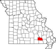 | |
| Villages | ||
| Townships | ||
| Unincorporated communities | ||
| Ghost towns |
| |