Lancaster, Missouri
| Lancaster, Missouri | |
|---|---|
| City | |
|
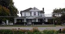
Lancaster City Hall | |
 Location of Lancaster, Missouri | |
| Coordinates: 40°31′27″N 92°31′45″W / 40.52417°N 92.52917°WCoordinates: 40°31′27″N 92°31′45″W / 40.52417°N 92.52917°W | |
| Country | United States |
| State | Missouri |
| County | Schuyler |
| Area[1] | |
| • Total | 1.50 sq mi (3.88 km2) |
| • Land | 1.49 sq mi (3.86 km2) |
| • Water | 0.01 sq mi (0.03 km2) |
| Elevation | 942 ft (287 m) |
| Population (2010)[2] | |
| • Total | 728 |
| • Estimate (2012[3]) | 717 |
| • Density | 488.6/sq mi (188.6/km2) |
| Time zone | Central (CST) (UTC-6) |
| • Summer (DST) | CDT (UTC-5) |
| ZIP code | 63548 |
| Area code(s) | 660 |
| FIPS code | 29-40610[4] |
| GNIS feature ID | 0720781[5] |
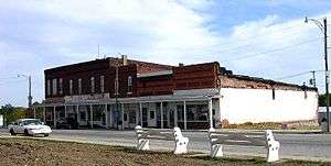
Lancaster is a city in Schuyler County, Missouri, in the United States. As of the 2010 census, the city population was 728. It is the county seat of Schuyler County.[6]
Lancaster is part of the Kirksville Micropolitan Statistical Area.

History
Lancaster was designated county seat in 1847.[7]
Geography
Lancaster is located at 40°31′27″N 92°31′45″W / 40.52417°N 92.52917°W (40.524087, -92.529190).[8] According to the United States Census Bureau, the city has a total area of 1.50 square miles (3.88 km2), of which, 1.49 square miles (3.86 km2) is land and 0.01 square miles (0.03 km2) is water.[1]
Demographics
| Historical population | |||
|---|---|---|---|
| Census | Pop. | %± | |
| 1870 | 427 | — | |
| 1880 | 528 | 23.7% | |
| 1890 | 811 | 53.6% | |
| 1900 | 980 | 20.8% | |
| 1910 | 964 | −1.6% | |
| 1920 | 859 | −10.9% | |
| 1930 | 807 | −6.1% | |
| 1940 | 886 | 9.8% | |
| 1950 | 856 | −3.4% | |
| 1960 | 740 | −13.6% | |
| 1970 | 821 | 10.9% | |
| 1980 | 855 | 4.1% | |
| 1990 | 785 | −8.2% | |
| 2000 | 737 | −6.1% | |
| 2010 | 728 | −1.2% | |
| Est. 2015 | 724 | [9] | −0.5% |
2010 census
As of the census[2] of 2010, there were 728 people, 326 households, and 187 families residing in the city. The population density was 488.6 inhabitants per square mile (188.6/km2). There were 367 housing units at an average density of 246.3 per square mile (95.1/km2). The racial makeup of the city was 98.2% White, 0.5% Asian, 0.1% from other races, and 1.1% from two or more races. Hispanic or Latino of any race were 0.7% of the population.
There were 326 households of which 29.4% had children under the age of 18 living with them, 39.6% were married couples living together, 14.1% had a female householder with no husband present, 3.7% had a male householder with no wife present, and 42.6% were non-families. 38.0% of all households were made up of individuals and 20.8% had someone living alone who was 65 years of age or older. The average household size was 2.23 and the average family size was 2.96.
The median age in the city was 38.3 years. 26.2% of residents were under the age of 18; 8.2% were between the ages of 18 and 24; 22.6% were from 25 to 44; 22.9% were from 45 to 64; and 20.2% were 65 years of age or older. The gender makeup of the city was 46.4% male and 53.6% female.
2000 census
As of the census[4] of 2000, there were 737 people, 319 households, and 203 families residing in the city. The population density was 494.7 people per square mile (191.0/km²). There were 370 housing units at an average density of 248.4/sq mi (95.9/km²). The racial makeup of the city was 99.46% White, 0.14% Native American, 0.14% Pacific Islander, 0.27% from other races. Hispanic or Latino of any race were 0.41% of the population.
There were 319 households out of which 29.5% had children under the age of 18 living with them, 51.7% were married couples living together, 10.7% had a female householder with no husband present, and 36.1% were non-families. 33.5% of all households were made up of individuals and 21.6% had someone living alone who was 65 years of age or older. The average household size was 2.31 and the average family size was 2.93.
In the city the population was spread out with 25.4% under the age of 18, 7.7% from 18 to 24, 23.7% from 25 to 44, 19.7% from 45 to 64, and 23.5% who were 65 years of age or older. The median age was 40 years. For every 100 females there were 80.2 males. For every 100 females age 18 and over, there were 77.4 males.
The median income for a household in the city was $27,202, and the median income for a family was $37,083. Males had a median income of $28,889 versus $19,063 for females. The per capita income for the city was $14,263. About 13.8% of families and 18.9% of the population were below the poverty line, including 29.3% of those under age 18 and 9.5% of those age 65 or over.
Notable people
- Howard R. Hughes, Sr., co-founder of the Hughes Tool Company and father of Howard Robard Hughes, Jr., the reclusive multi-millionaire.
- Rupert Hughes, well known novelist and Oscar-winning screenwriter. Brother of Howard Hughes Sr. and uncle of Howard Hughes, Jr.
- William Preston Hall (aka "the Colonel," "Diamond Billy," "Horse King of the World") (February 29, 1864 – June 29, 1932) Circus empresario, dealer in exotic animals, horses, and mules.
- Bob Melvin (aka "The Man With Two Faces"), sideshow performer and actor.
References
- 1 2 "US Gazetteer files 2010". United States Census Bureau. Retrieved 2012-07-08.
- 1 2 "American FactFinder". United States Census Bureau. Retrieved 2012-07-08.
- ↑ "Population Estimates". United States Census Bureau. Retrieved 2013-05-30.
- 1 2 "American FactFinder". United States Census Bureau. Retrieved 2008-01-31.
- ↑ "US Board on Geographic Names". United States Geological Survey. 2007-10-25. Retrieved 2008-01-31.
- ↑ "Find a County". National Association of Counties. Retrieved 2011-06-07.
- ↑ Eaton, David Wolfe (1918). How Missouri Counties, Towns and Streams Were Named. The State Historical Society of Missouri. p. 362.
- ↑ "US Gazetteer files: 2010, 2000, and 1990". United States Census Bureau. 2011-02-12. Retrieved 2011-04-23.
- ↑ "Annual Estimates of the Resident Population for Incorporated Places: April 1, 2010 to July 1, 2015". Retrieved July 2, 2016.
- ↑ "Census of Population and Housing". Census.gov. Retrieved June 4, 2015.
External links
- Historic maps of Lancaster in the Sanborn Maps of Missouri Collection at the University of Missouri
Municipalities and communities of Schuyler County, Missouri, United States | ||
|---|---|---|
| Cities | 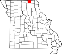 | |
| Village | ||
| Townships |
| |
| Unincorporated community | ||
| Footnotes | ‡This populated place also has portions in an adjacent county or counties | |