Carrollton, Missouri
| Carrollton, Missouri | |
|---|---|
| City | |
|
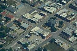
Aerial view of Carrollton, Missouri | |
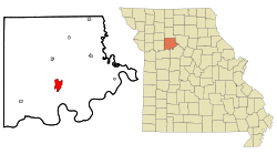 Location of Carrollton, Missouri | |
| Coordinates: 39°21′32″N 93°29′44″W / 39.35889°N 93.49556°WCoordinates: 39°21′32″N 93°29′44″W / 39.35889°N 93.49556°W | |
| Country | United States |
| State | Missouri |
| County | Carroll |
| Government | |
| • Type | Mayor-council |
| • Mayor | Bryan Mathis |
| Area[1] | |
| • Total | 4.19 sq mi (10.85 km2) |
| • Land | 4.17 sq mi (10.80 km2) |
| • Water | 0.02 sq mi (0.05 km2) |
| Elevation | 755 ft (230 m) |
| Population (2010)[2] | |
| • Total | 3,784 |
| • Estimate (2012[3]) | 3,691 |
| • Density | 907.4/sq mi (350.3/km2) |
| Time zone | Central (CST) (UTC-6) |
| • Summer (DST) | CDT (UTC-5) |
| ZIP code | 64633 |
| Area code(s) | 660 |
| FIPS code | 29-11566[4] |
| GNIS feature ID | 0715434[5] |
| Website | Carrollton Area Chamber of Commerce |
Carrollton is a city in Carroll County, Missouri, United States. Carrollton won the 2005 All-America City Award given out annually by the National Civic League. The population was 3,784 at the 2010 census. The population is down 338 residents since the last census, the 2000 census. It is the county seat of Carroll County.[6]
Geography
Carrollton is located at 39°22′N 93°30′W / 39.367°N 93.500°W (39.3589, -93.4956).[7] According to the United States Census Bureau, the city has a total area of 4.19 square miles (10.85 km2), of which, 4.17 square miles (10.80 km2) is land and 0.02 square miles (0.05 km2) is water.[1]
Demographics
| Historical population | |||
|---|---|---|---|
| Census | Pop. | %± | |
| 1860 | 738 | — | |
| 1870 | 1,832 | 148.2% | |
| 1880 | 2,313 | 26.3% | |
| 1890 | 3,878 | 67.7% | |
| 1900 | 3,854 | −0.6% | |
| 1910 | 3,452 | −10.4% | |
| 1920 | 3,218 | −6.8% | |
| 1930 | 4,058 | 26.1% | |
| 1940 | 4,070 | 0.3% | |
| 1950 | 4,380 | 7.6% | |
| 1960 | 4,554 | 4.0% | |
| 1970 | 4,847 | 6.4% | |
| 1980 | 4,700 | −3.0% | |
| 1990 | 4,406 | −6.3% | |
| 2000 | 4,122 | −6.4% | |
| 2010 | 3,784 | −8.2% | |
| Est. 2015 | 3,638 | [8] | −3.9% |
2010 census
As of the census[4] of 2010, there were 3,784 people,
Total population: 3,784
% of population.....
Under 5 years: 249 (6.6%);5 to 9 years: 243 (6.4%);10 to 14 years: 256 (6.8%); 15 to 19 years: 254 (6.7%); 20 to 24 years: 203 (5.4%); 25 to 29 years: 213 (5.6%); 30 to 34 years: 239 (6.3%); 35 to 39 years: 219 (5.8%); 40 to 44 years: 215 (5.7%); 45 to 49 years: 234 (6.2%); 50 to 54 years: 210 (5.5%); 55 to 59 years: 241 (6.4%); 60 to 64 years: 241 (6.4%); 65 to 69 years: 186 (4.9%); 70 to 74 years: 159 (4.2%); 75 to 79 years: 150 (4.0%); 80 to 84 years: 125 (3.3%); 85 years and over: 147 (3.9%)
Median age (years): 40.4
Population Summary
People 16 years and over: 2,975 (78.6%); 18 years and over: 2,867 (75.8%); 21 years and over: 2,733 (72.2%); 62 years and over: 912 (24.1%); 65 years and over: 767 (20.3%)
Source: U.S. Census Bureau, 2010 Census.
Education
Carrollton Area Career Center, Carrollton High School; grades 9-12, Carrollton Junior High School; grades 7-8, Carrollton Elementary School; grades 2-6, and Adams School; grades Pre-K-1.
History
Carrollton was established in 1833.[10] It obtained its post office in 1834.[11] Carrollton's growth can be documented through Sanborn Maps, several of which are available online.[12]
The town's recent claim to fame was its baseball team, the Carrollton Trojans, who finished 2nd in Class 2A baseball in their 2009-10 season. After advancing to the Final 4 in the MSHSAA Class 2A Baseball Championships, the Trojans defeated the Conway Bears (MO) 5-3, then fell to Crystal City (MO) in the title game, 10-1. The Trojans finished the season with a record of 19-3.
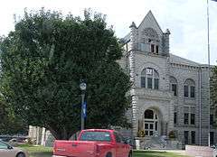
The Carroll County Court House, Carroll County Sheriff's Quarters and Jail, United States Post Office, and Wilcoxson and Company Bank are listed on the National Register of Historic Places.[13]
Notable people
- Thomas Archibald, Colonel, US Army, Vietnam Veteran. 1958-1980. University Vice President, 1980-2002.
- Leon E. Bates UAW Leader
- James H. Boyce, chairman of the Louisiana Republican Party from 1972 to 1976; born in Carrollton in 1922, died in Baton Rouge, 1990
- James Johnson Duderstadt, President of the University of Michigan. 1988-1996
- James Fergason, (January 12, 1934 – December 9, 2008) Graduated Carrollton High School in 1952. American inventor and business entrepreneur. A member of the National Inventors Hall of Fame. Best known for his work on an improved Liquid Crystal Display, or LCD. He held over one hundred U.S. patents at the time of his death.
- Francis Doyle Gleeson, Roman Catholic bishop
- Brie Lowrey, craft beer enthusiast, blogger and acrobat. Traveled with the Kansas City Batarangs from 2006-2008.
- Don Martin Defensive Back for Yale. Played in the NFL for the Buccaneers, Chiefs, and the Patriots, and coached in the NFL for the Oakland Raiders.
- James Shields Civil War General and United States Senator
- Robert Simpson (athlete) Robert Ingalls "Bob" Simpson (May 25, 1892 – November 10, 1974) was an American hurdler and track and field coach. Simpson set several world records in the 120 yd hurdles, equaled the world record in the 220 yd hurdles, and won two gold medals at the 1919 Inter-Allied Games. Simpson grew up on his family's farm in Bosworth, near Carrollton, Missouri. He was the oldest of three brothers and part of a track and field family. His younger brothers John Simpson and Chauncey Simpson followed him in the sport, as did his cousin, William Sylvester.
- Claude T. Smith American band conductor, composer, and educator.
References
- 1 2 "US Gazetteer files 2010". United States Census Bureau. Archived from the original on 2012-07-14. Retrieved 2012-07-08.
- ↑ "American FactFinder". United States Census Bureau. Retrieved 2012-07-08.
- ↑ "Population Estimates". United States Census Bureau. Archived from the original on 2013-06-17. Retrieved 2013-05-30.
- 1 2 "American FactFinder". United States Census Bureau. Archived from the original on 2013-09-11. Retrieved 2008-01-31.
- ↑ "US Board on Geographic Names". United States Geological Survey. 2007-10-25. Retrieved 2008-01-31.
- ↑ "Find a County". National Association of Counties. Archived from the original on 2011-05-31. Retrieved 2011-06-07.
- ↑ "US Gazetteer files: 2010, 2000, and 1990". United States Census Bureau. 2011-02-12. Retrieved 2011-04-23.
- ↑ "Annual Estimates of the Resident Population for Incorporated Places: April 1, 2010 to July 1, 2015". Retrieved July 2, 2016.
- ↑ "Census of Population and Housing". Census.gov. Archived from the original on May 11, 2015. Retrieved June 4, 2015.
- ↑ "Carroll County Place Names, 1928–1945 (archived)". The State Historical Society of Missouri. Archived from the original on 24 June 2016. Retrieved 10 September 2016.
- ↑ Earngey, Bill (1995). Missouri Roadsides: The Traveler's Companion. University of Missouri Press. p. 38.
- ↑ Sanborn Maps for Missouri: Carrollton, University of Missouri Digital Library. Accessed 2011-03-14
- ↑ National Park Service (2010-07-09). "National Register Information System". National Register of Historic Places. National Park Service.
External links
- Carrollton Area Chamber of Commerce
- Historic maps of Carrollton in the Sanborn Maps of Missouri Collection at the University of Missouri
Municipalities and communities of Carroll County, Missouri, United States | ||
|---|---|---|
| Cities |  | |
| Village | ||
| Townships | ||
| Unincorporated communities | ||
| Ghost towns | ||